Deoban
Deoban (Hindi: देववन) is a mountain of Garhwal Himalaya in Uttarakhand, India. Deoban stands at 6855 meter 22490 feet. Its joint 28th highest located entirely within the uttrakhand India. Nanda Devi, is the highest mountain in this category. Deoban is the 396th highest peak in the world.[3] Deoban located just south east of Mana Peak and west of Bidhan. on the south west side lies the Mandir Parbat.
| Deoban | |
|---|---|
| Devban | |
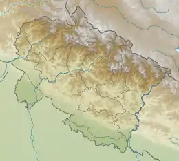
 Deoban Location in Uttarakhand | |
| Highest point | |
| Elevation | 6,855 m (22,490 ft) [1] |
| Prominence | 336 m (1,102 ft) [2] |
| Coordinates | 30°31′43″N 79°58′01″E |
| Geography | |
| Location | Uttarakhand, India |
| Parent range | Garhwal Himalaya |
| Climbing | |
| First ascent | The first ascent by Britishers On 4 August 1937. |
Climbing history
The first ascent of Deoban by Britishers by Frank Smythe's party On 4 August 1937.[4] A twelve-member Indian Military Academy team climbed Deoban 1968.[4] In August 2009 a nine members team of Ordinance Factories Mountaineers & Trekkers from west Bengal Led by Samrat Basu. In the post monsoon season approached Deoban from the Amrit Ganga valley. They established their base camp on the right bank of Amrit Ganga at Eri Udiyar. Camp 3 was established on Upper Bidhan glacier and summit camp at 6320 meter. They climbed the northwest ridge and finally reached via the west ridge. On 28 August Samrat Basu with Ashim Ghosh, Tapas Dey, Prosenjit Bagchi along with 4 high altitude supporters reached the summit.[5]
Glaciers and rivers
It is surrounded by glaciers on the both the side Purbi Kamet Glacier, on the northern side and Bidhan Glacier on the southern side. The River Dhauli Ganga emerges from Purbi Kamet Glacier and met Alaknanda river at Vishnu Prayag an 82 km journey from its mouth. Alaknanda river is one of the main tributaries of Ganga.
Neighboring peaks
The neighboring peaks of Deoban:
- Kamet: 7,756 m (25,446 ft)30°55′12″N 79°35′30″E
- Mana Peak: 7,272 m (23,858 ft)30°52′50″N 79°36′55″E
- Mana Northwest: 7,092 m (23,268 ft)30°53′37″N 79°35′57″E
- Bidhan: 6,520 m (21,391 ft)30°51′48″N 79°40′49″E
- Mandir Parbat: 6,559 m (21,519 ft)30°49′40″N 79°36′14″E
See also
- List of Himalayan peaks of Uttarakhand
References
- "Himalayan Index - Results of Search by Group". www.alpine-club.org.uk.
- "Deoban". PeakVisor.
- https://4sport.ua/_upl/2/1442/highasiato6650DRAFT-a-and-b-peaks.pdf
- "ASIA, INDIA, GARHWAL, DEOBAN". americanalpineclub.org. 1969. Retrieved 23 April 2020.
- "Indian Himalaya: Climbing and Other News - 2009". www.himalayanclub.org.