Derryvahan
Derryvahan (from Irish: Doire Mheathán meaning – The Oakwood of the Saplings) is a townland in the civil parish of Templeport, County Cavan, Ireland. It lies in the Roman Catholic parish of Corlough and barony of Tullyhaw.
Geography
Derryvahan is bounded on the north by Drumcar (Kinawley) townland, on the south by Garvary (Corlough) and Scrabby, Corlough townlands, on the west by Curraghabweehan and Drumbeagh townlands and on the east by Tawnagh and Derrynacreeve townlands. Its chief geographical features are the Owensallagh river (A source of the River Blackwater, County Cavan), a stream and dug wells. Derryvahan is traversed by the R202 road (Ireland), the R200 road and rural lanes. The townland covers 105 statute acres.[1]
History
In earlier times the townland was probably uninhabited as it consists mainly of bog and poor clay soils. It was not seized by the English during the Plantation of Ulster in 1610 or in the Cromwellian Settlement of the 1660s so some dispossessed Irish families moved there and began to clear and farm the land.
A map of the townland drawn in 1813 is in the National Archives of Ireland, Beresford Estate Maps, depicts the townland as Derryvaghan or Derrynoghan.[2]
The Tithe Applotment Books for 1827 list eight tithepayers in the townland.[3]
The Derryvahan Valuation Office Field books are available for September 1839.[4]
In 1841 the population of the townland was 44, being 20 males and 24 females. There were nine houses in the townland, of which one was uninhabited.[5]
In 1851 the population of the townland was 48, being 23 males and 25 females. There were eight houses in the townland, all were inhabited.[6]
Griffith's Valuation of 1857 lists nine landholders in the townland.[7]
In 1861 the population of the townland was 47, being 24 males and 23 females. There were ten houses in the townland and all were inhabited apart from one in the course of erection.[8]
In the 1901 census of Ireland, there are twelve families listed in the townland, [9] and in the 1911 census of Ireland, there are eight families listed in the townland.[10]
A description of Derryvahan in the 1930s by Brigid Josephine Mc Govern is available at [11]
Antiquities
There are no known antiquities in the townland
References
- "IreAtlas". Retrieved 29 February 2012.
- "Search Results - tullyhaw". catalogue.nli.ie.
- "The Tithe Applotment Books, 1823-37". titheapplotmentbooks.nationalarchives.ie.
- "Griffith's Valuation". www.askaboutireland.ie.
- "National Archives: Census of Ireland 1911". www.census.nationalarchives.ie.
- "National Archives: Census of Ireland 1911". www.census.nationalarchives.ie.
- "Tomena - The Schools' Collection". dúchas.ie.
External links
Places in County Cavan | ||
|---|---|---|
| Towns | 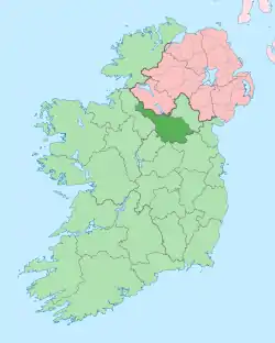 | |
| Villages |
| |
| Townlands | ||
| ||