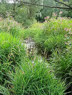
Dober (Kremnitz)
Dober, also called Doberbach, is a river of Thuringia and Bavaria , Germany.
| Dober | |
|---|---|
 | |
| Location | |
| Country | Germany |
| States | Thuringia and Bavaria |
| Physical characteristics | |
| Source | |
| • location | in the Franconian Forest, south of the Wetzstein and southwest of Brennersgrün, a district of Lehesten) |
| • elevation | about 688 metres (2,257 ft) |
| Mouth | |
• location | Northwest of Lahm, a district of Wilhelmsthal into the Kremnitz |
• coordinates | 50.3521°N 11.3848°E |
• elevation | 422 metres (1,385 ft) |
| Length | 11.8 kilometres (7.3 mi) |
| Basin features | |
| Progression | Kremnitz→ Kronach→ Haßlach→ Rodach→ Main→ Rhine→ North Sea |
| Tributaries | |
| • left | Dorfbach |
| • right | Schwarze Sutte |
The Dober is about 12 kilometres (7.5 mi) long and is a left tributary of the Kremnitz. Its source is in the Franconian Forest, south of the Wetzstein and southwest of Brennersgrün, a district of Lehesten). Northwest of Lahm, a district of Wilhelmsthal, the Dober flows into the Kremnitz.
Tributaries of the Dober are the Schwarze Sutte from the right and the Dorfbach (in Tschirn) from the left.
This article is issued from Wikipedia. The text is licensed under Creative Commons - Attribution - Sharealike. Additional terms may apply for the media files.