Doorley Creek
Doorley Creek is a stream in Greater Madawaska, Renfrew County in Eastern Ontario, Canada.[1][3][4][5][6] It is in the Saint Lawrence River drainage basin and is a right tributary of Black Donald Creek.
| Doorley Creek | |
|---|---|
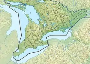 Location of the mouth of the creek in Southern Ontario | |
| Location | |
| Country | Canada |
| Province | Ontario |
| Region | Eastern Ontario |
| County | Renfrew |
| Municipality | Greater Madawaska |
| Physical characteristics | |
| Source confluence | Confluence of two unnamed creeks |
| • coordinates | 45°18′13″N 77°03′45″W[1] |
| • elevation | 347 m (1,138 ft)[2] |
| Mouth | Black Donald Creek |
• coordinates | 45°17′35″N 77°01′09″W[3] |
• elevation | 275 m (902 ft)[2] |
| Basin features | |
| River system | Saint Lawrence River drainage basin |
Course
Doorley Creek begins at the confluence of two unnamed creeks just north of Ontario Highway 41. It flows southeast under the highway, then under the local Doorley Creek Road; from this point to its mouth, it is paralleled by the road. The creek turns south, then again southeast, and reaches its mouth at Black Donald Creek. Black Donald Creek flows via Black Donald Lake, the Madawaska River, and the Ottawa River to the Saint Lawrence River.[1][3][4]
References
- "Toporama (on-line map and search)". Atlas of Canada. Natural Resources Canada. Retrieved 2018-10-07.
- "Google Earth". Retrieved 2018-10-07.
- "Doorley Creek". Geographical Names Data Base. Natural Resources Canada. Retrieved 2018-10-07.
- "Ontario Geonames GIS (on-line map and search)". Ontario Ministry of Natural Resources and Forestry. 2014. Retrieved 2018-10-07.
- Map 10 (PDF) (Map). 1 : 700,000. Official road map of Ontario. Ministry of Transportation of Ontario. 2018-01-01. Retrieved 2018-10-07.
- Restructured municipalities - Ontario map #5 (Map). Restructuring Maps of Ontario. Ontario Ministry of Municipal Affairs and Housing. 2006. Retrieved 2018-10-07.
This article is issued from Wikipedia. The text is licensed under Creative Commons - Attribution - Sharealike. Additional terms may apply for the media files.