Dos Bocas, Corozal, Puerto Rico
Dos Bocas (Barrio Dos Bocas) is a rural barrio with an urban zone in the municipality of Corozal, Puerto Rico. Its population in 2010 was 3,060.[3][4][5]
Dos Bocas | |
|---|---|
Barrio | |
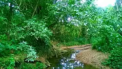 Río de los Negros in Dos Bocas | |
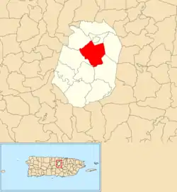 Location of Dos Bocas within the municipality of Corozal shown in red | |
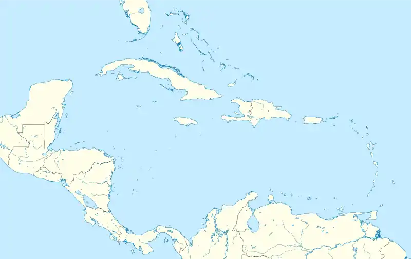 Dos Bocas Location of Puerto Rico | |
| Coordinates: 18°19′10″N 66°19′12″W[1] | |
| Commonwealth | |
| Municipality | |
| Area | |
| • Total | 4.06 sq mi (10.5 km2) |
| • Land | 4.06 sq mi (10.5 km2) |
| • Water | 0 sq mi (0 km2) |
| Elevation | 512 ft (156 m) |
| Population (2010) | |
| • Total | 3,060 |
| • Density | 753.7/sq mi (291.0/km2) |
| Source: 2010 Census | |
| Time zone | UTC−4 (AST) |
Features and demographics
Dos Bocas has 4.06 square miles (10.5 km2) of land area and no water area. In 2010, its population was 3,060 with a population density of 753.7 inhabitants per square mile (291.0/km2).
| Historical population | |||
|---|---|---|---|
| Census | Pop. | %± | |
| 1900 | 909 | — | |
| 1910 | 1,005 | 10.6% | |
| 1920 | 1,124 | 11.8% | |
| 1930 | 1,275 | 13.4% | |
| 1940 | 1,447 | 13.5% | |
| 1950 | 1,890 | 30.6% | |
| 1980 | 2,172 | — | |
| 1990 | 2,640 | 21.5% | |
| 2000 | 2,760 | 4.5% | |
| U.S. Decennial Census[6] 1899 (shown as 1900)[7] 1910-1930[8] 1930-1950[9] 1980-2000[10] 2010[11] | |||
History
Puerto Rico was ceded by Spain in the aftermath of the Spanish–American War under the terms of the Treaty of Paris of 1898 and became a territory of the United States. In 1899, the United States conducted its first census of Puerto Rico finding that the population of Dos Bocas barrio was 909.[12]
Sectors
Barrios (which are like minor civil divisions)[13] in turn are further subdivided into smaller local populated place areas/units called sectores (sectors in English). The types of sectores may vary, from normally sector to urbanización to reparto to barriada to residencial, among others.[14][15][16]
The following sectors are in Dos Bocas barrio:[17]
Calle Leoncito Ortiz, Parcelas Ortiz, Sector Ángel Vázquez, Sector Benjamín González, Sector Bernardo Padilla, Sector Caldero, Sector Carmelo Ortiz (Los Batatos), Sector Carretera (from Dos Bocas entrance to Sector Mingo Díaz), Sector Daniel Negrón, Sector El Faro, Sector El Quinto, Sector El Típico, Sector Honduras, Sector Julio Vázquez, Sector La Mina, Sector La Santa, Sector Leoncito Ortíz, Sector Los García, Sector Los Maldonado, Sector Los Marrero, Sector Los Miranda, Sector Mingo Díaz, Sector Moncho Santos, Sector Neco Chévere, Sector Sioso Virella, Urbanización Loma Linda, and Urbanización San Francisco.
References
- "US Gazetteer 2019". US Census. US Government.
- U.S. Geological Survey Geographic Names Information System: Dos Bocas barrio
- Picó, Rafael; Buitrago de Santiago, Zayda; Berrios, Hector H. Nueva geografía de Puerto Rico: física, económica, y social, por Rafael Picó. Con la colaboración de Zayda Buitrago de Santiago y Héctor H. Berrios. San Juan Editorial Universitaria, Universidad de Puerto Rico,1969.
- Gwillim Law (20 May 2015). Administrative Subdivisions of Countries: A Comprehensive World Reference, 1900 through 1998. McFarland. p. 300. ISBN 978-1-4766-0447-3. Retrieved 25 December 2018.
- Puerto Rico:2010:population and housing unit counts.pdf (PDF). U.S. Dept. of Commerce, Economics and Statistics Administration, U.S. Census Bureau. 2010.
- "U.S. Decennial Census". United States Census Bureau. Archived from the original on February 13, 2020. Retrieved September 21, 2017.
- "Report of the Census of Porto Rico 1899". War Department Office Director Census of Porto Rico. Archived from the original on July 16, 2017. Retrieved September 21, 2017.
- "Table 3-Population of Municipalities: 1930 1920 and 1910" (PDF). United States Census Bureau. Archived (PDF) from the original on August 17, 2017. Retrieved September 21, 2017.
- "Table 4-Area and Population of Municipalities Urban and Rural: 1930 to 1950" (PDF). United States Census Bureau. Archived (PDF) from the original on August 30, 2015. Retrieved September 21, 2014.
- "Table 2 Population and Housing Units: 1960 to 2000" (PDF). United States Census Bureau. Archived (PDF) from the original on July 24, 2017. Retrieved September 21, 2017.
- Puerto Rico:2010:population and housing unit counts.pdf (PDF). U.S. Dept. of Commerce Economics and Statistics Administration U.S. Census Bureau. 2010. Archived (PDF) from the original on 2017-02-20. Retrieved 2019-08-02.
- Joseph Prentiss Sanger; Henry Gannett; Walter Francis Willcox (1900). Informe sobre el censo de Puerto Rico, 1899, United States. War Dept. Porto Rico Census Office (in Spanish). Imprenta del gobierno. p. 161.
- "US Census Barrio-Pueblo definition". factfinder.com. US Census. Archived from the original on 13 May 2017. Retrieved 5 January 2019.
- "Agencia: Oficina del Coordinador General para el Financiamiento Socioeconómico y la Autogestión (Proposed 2016 Budget)". Puerto Rico Budgets (in Spanish). Retrieved 28 June 2019.
- Rivera Quintero, Marcia (2014), El vuelo de la esperanza: Proyecto de las Comunidades Especiales Puerto Rico, 1997-2004 (first ed.), San Juan, Puerto Rico Fundación Sila M. Calderón, ISBN 978-0-9820806-1-0
- "Leyes del 2001". Lex Juris Puerto Rico (in Spanish). Retrieved 24 June 2020.
- "PRECINTO ELECTORAL COROZAL 072" (PDF). Comisión Estatal de Elecciones (in Spanish). PR Government. 21 September 2019. Retrieved 24 June 2020.
- "P.L. 94-171 VTD/SLD Reference Map 001 (2010 Census): Corozal Municipio, PR" (PDF). www2.census.gov. U.S. DEPARTMENT OF COMMERCE Economics and Statistics Administration U.S. Census Bureau. Archived (PDF) from the original on 22 August 2020. Retrieved 23 August 2020.