Dry Creek (Mokelumne River tributary)
Dry Creek is a 47.1-mile-long (75.8 km)[1] stream in northern California which runs from the Sierra Nevada to the Mokelumne River west of Galt.
| Dry Creek | |
|---|---|
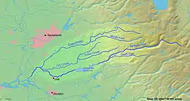 Map of the Mokelumne River watershed | |
| Location | |
| Country | United States |
| State | California |
| Region | Amador County, Sacramento County, San Joaquin County |
| Physical characteristics | |
| Source | |
| • coordinates | 38°28′13″N 120°48′40″W |
| Mouth | Mokelumne River |
• location | California, United States |
• coordinates | 38°13′55″N 121°24′42″W |
• elevation | 13 ft (4.0 m) |
Tributaries
- North Fork Dry Creek
- South Fork Dry Creek
- Sutter Creek
- Jackson Creek
See also
| Wikimedia Commons has media related to Dry Creek (Mokelumne River). |
References
- U.S. Geological Survey. National Hydrography Dataset high-resolution flowline data. The National Map Archived 2012-04-05 at WebCite, accessed March 11, 2011
This article is issued from Wikipedia. The text is licensed under Creative Commons - Attribution - Sharealike. Additional terms may apply for the media files.