East Caracas
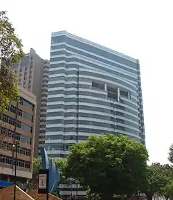
East Caracas generally refers to the eastern portions of Caracas, and may refer specifically to the municipalities from the Metropolitan District of Caracas located in Miranda State: Chacao, Baruta, Sucre, and El Hatillo. It concentrates the 34.8% population of the Metropolitan District of Caracas, and the 21.7% population of the Greater Caracas Area. Caracas Country Club, the richest neighborhood of the city, is located between El Recreo and Chacao districts.
East | |
|---|---|
Municipalities of East Caracas | |
 | |
| Coordinates: 10.25°N 66.52°W | |
| Sovereign state | Venezuela |
| State | Miranda |
| City | Metropolitan District of Caracas |
| Comprises | Chacao, Altamira, Baruta, El Hatillo, Petare |
| Area | |
| • Total | 344.1 km2 (132.9 sq mi) |
| Population | |
| • Total | 1,140,756 |
| • Density | 3,300/km2 (8,600/sq mi) |
Until some years ago, it was one of the safest regions of Caracas since most neighbourhoods on the eastern side had a slightly lower crime rate,[1][2][3][4] but now the situation has changed. Crime is rampant in all the districts of the city.[5] Some of the eastern neighborhoods of Caracas report a high rate of kidnappings, but also some neighborhoods in downtown such as San Bernardino. [6]
Geography
Limits and extent
| Municipality | Baruta | Chacao | El Hatillo | Sucre |
|---|---|---|---|---|
| Location | 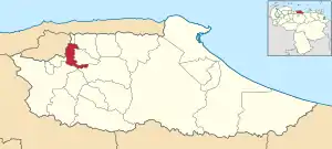 | 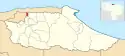 | 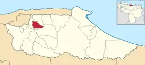 | 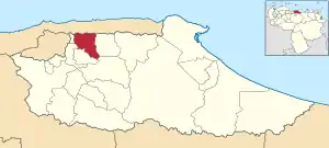 |
| Major centres | Baruta | Chacao | El Hatillo | Petare |
| Population (2013)[7] | 326,377 | 71,085 | 74,006 | 669,288 |
Division
East Caracas is divided geographically in Eastern Caracas and Southeastern Caracas. The list of neighborhoods are:
- Eastern (Miranda): El Pedregal, San Marino, Campo Alegre, Chacao, Bello Campo, El Rosal, El Retiro, Las Mercedes, Tamanaco, Chuao, Altamira, Los Palos Grandes, La Castellana, La Floresta, Santa Eduvigis, Sebucán, La Carlota, Santa Cecilia, Campo Claro, Los Ruices, Montecristo, Los Chorros, Los Dos Caminos, Boleíta, Los Cortijos, La California, Horizonte, El Marqués, La Urbina, Terrazas del Ávila, Lomas del Ávila, El Llanito, Macaracuay, La Guairita, Caurimare, El Cafetal, San Román, Santa Rosa, San Luis, Santa Sofía, Santa Paula, Santa Inés, Los Pomelos, Palo Verde, Petare.
- Southeastern (Miranda): Valle Arriba, Santa Fe, Los Campitos, Prados del Este, Alto Prado, Manzanares, El Peñón, Baruta, Piedra Azul, La Trinidad, La Tahona, Monterrey, Las Minas, Los Samanes, Cerro Verde, Los Naranjos, La Boyera, Alto Hatillo, El Hatillo, Los Geranios, La Lagunita, El Placer, El Guayabao, El Volcán, La Unión, Sartanejas.
- Eastern (Libertador): Los Caobos, Las Palmas, San Rafael, Colina, Bello Monte, Sabana Grande, San Antonio, Las Delicias, Hoyo de Las Delicias, La Florida, Los Cedros, Alta Florida, La Campiña.
Notes
External links
References
- http://soundsandcolours.com/subjects/travel/calling-on-caracas-3872/ In the east, the streets are safer but it’s too cheap to walk.
- https://www.nytimes.com/2014/03/01/world/americas/slum-dwellers-in-caracas-ask-what-protests.html?_r=0 On the east side of this capital city, where the rich people tend to live
- http://www.noticierodigital.com/2013/08/vea-usted-si-vive-en-una-zona-segura-menos-segura-o-insegura-de-acuerdo-con-la-embajada-de-ee-uu-en-caracas/
- http://www.localyte.com/answers/1224 Safest neighborhoods in Caracas?
- "Los Palos Grandes reclama mayor seguridad". El Nacional (in Spanish). 2015-12-14. Retrieved 2018-04-23.
- Toro, Satya (2018-01-11). "Las 11 zonas con mayor incidencia de secuestro en Caracas". El Nacional (in Spanish). Retrieved 2018-04-23.
- http://www.cne.gov.ve/web/normativa_electoral/elecciones/2013/municipales/circunscripciones/CabildoMetropolitano.pdf Cabildo Metropolitano del Área Metropolitana de Caracas