Erg Amatlich
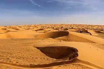
Located south-west of the city of Atar in Mauritania, erg Amatlich is a vast dune barrier of small dimensions (130 km x 5 km to 8 km) trapped between the mountains of the Adrar plateau. The erg, stretching from NW to SE, originates at the cliffs of the Tifoujar Pass and extends to the Akjoujt area where it takes the name of Dkhaïna extending to the Atlantic Ocean.[1]
Erg Amatlich | |
|---|---|
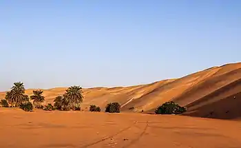 Sand dune in erg Amatlich | |
| Coordinates: 19°24′N 14°10′W | |
| Country | Mauritania |
| Elevation | 100 m (300 ft) |
In addition to endless dunes, Erg Amatlich gathers a great variety of Saharan landscapes such as canyons, cliffs, cultivable basins and palm groves like Azoueïga, located on the west side of the erg.[2]
There are many Neolithic sites, such as the Khatt Lemaiteg.[3] · [4]
Climate of erg Amatlich
| Erg Amatlich | ||||||||||||||||||||||||||||||||||||||||||||||||||||||||||||
|---|---|---|---|---|---|---|---|---|---|---|---|---|---|---|---|---|---|---|---|---|---|---|---|---|---|---|---|---|---|---|---|---|---|---|---|---|---|---|---|---|---|---|---|---|---|---|---|---|---|---|---|---|---|---|---|---|---|---|---|---|
| Climate chart (explanation) | ||||||||||||||||||||||||||||||||||||||||||||||||||||||||||||
| ||||||||||||||||||||||||||||||||||||||||||||||||||||||||||||
| ||||||||||||||||||||||||||||||||||||||||||||||||||||||||||||
References
- Erg Amatlich in geoview (Retrieved 21 March 2020).
- Erg Amatlich (Retrieved 21 March 2020).
- Robert Vernet, Les Sites néolithiques de Khatt Lemaïteg (Amatlich) en Mauritanie occidentale, 1998.
- Nicole Lambert, Medinet Sbat et la protohistoire de Mauritanie occidentale, Antiquités africaines 1970 4, pp. 15-62.
This article is issued from Wikipedia. The text is licensed under Creative Commons - Attribution - Sharealike. Additional terms may apply for the media files.