Fall River (Ontario)
The Fall River is a river in Frontenac and Lanark Counties in Eastern Ontario, Canada.[1] It is part of the Ottawa River drainage basin, and flows from Sharbot Lake and through Bennett Lake to join the Mississippi River. The river is named after settlers of the late 17th century.
| Fall River | |
|---|---|
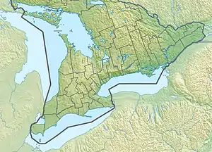 Location of the mouth of the Fall River in southern Ontario | |
| Location | |
| Country | Canada |
| Province | Ontario |
| Region | Eastern Ontario |
| Counties | |
| Physical characteristics | |
| Source | Sharbot Lake |
| • location | Central Frontenac, Frontenac County |
| • coordinates | 44°46′28″N 76°38′25″W |
| • elevation | 193 m (633 ft) |
| Mouth | Mississippi River |
• location | Tay Valley, Lanark County |
• coordinates | 44°58′23″N 76°21′37″W |
• elevation | 138 m (453 ft) |
| Length | 50 km (31 mi) |
| Basin features | |
| River system | Ottawa River drainage basin |
| Tributaries | |
| • left |
|
Course
The Fall River is fed from Sharbot Lake in Central Frontenac, Frontenac County and numerous springs, and it meanders along the Trans Canada Trail. It passes into Tay Valley, Lanark County and flows through the community of Maberly; fills the 20 km of Bennett Lake; flows by the community of Fallbrook; and about 50 kilometres (31 mi) from its origin, reaches its mouth at the Mississippi River.
Ecology
The river is bordered by forest and is home to fish, turtles, Blue Herons, beaver and otters
Tributaries
- Bolton Creek
- Silver Lake Creek
See also
References
- "Fall River". Geographical Names Data Base. Natural Resources Canada. Retrieved October 22, 2012.
Sources
- "Mississippi River watershed map". Mississippi Valley Conservation. 2009. Archived from the original (JPG) on January 1, 2013. Retrieved January 31, 2010.