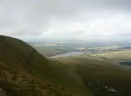
Fan Gyhirych
Fan Gyhirych is a mountain in the Fforest Fawr section of Brecon Beacons National Park in south Wales. It lies within the county of Breconshire, and administered as part of the unitary authority of Powys.[1]
| Fan Gyhirych | |
|---|---|
 The north face of Fan Gyhirych with Crai reservoir beyond | |
| Highest point | |
| Elevation | 725 m (2,379 ft) |
| Prominence | 280 m (920 ft) |
| Parent peak | Pen y Fan |
| Listing | Marilyn, Hewitt, Nuttall |
| Coordinates | 51.8590°N 3.6270°W |
| Naming | |
| Language of name | Welsh |
| Geography | |
| Location | Powys, Wales |
| Parent range | Brecon Beacons |
| Topo map | OS Landranger 160 |
| Listed summits of Fan Gyhirych | ||||
| Name | Grid ref | Height | Status | |
|---|---|---|---|---|
| Fan Fraith | SN969193 | 668 metres (2,192 ft) | Nuttall | |
| Yr Allt | SN969193 | 604 metres (1,982 ft) | sub Hewitt | |
Its highest point at 2379 feet (or 725 m) is marked by a trig point which is located towards the western side of the summit plateau. The hill drains to the north into the catchment of the Afon Crai and to the south and west into that of the River Tawe. Fan Fraith is a nearby hill which can be considered a subsidiary top of Fan Gyhirych.[2]
Geology
The hill is formed largely from sandstones of the Brownstones Formation of the Old Red Sandstone laid down during the Devonian period. A part of the summit plateau is capped by sandstones of the overlying Plateau Beds Formation which also occur on the nearby peak of Fan Fraith. The Cribarth Disturbance, a north-east to south-west aligned zone of faulting and folding, passes through the hill. The hill's finest feature is its north-eastern cwm which held a small glacier during the ice ages. The hill is within the Fforest Fawr Geopark designated in 2005 in recognition of the area's geological heritage.[3]
History
Along the lower western flanks of the hill, entrepreneur John Christie ran the Brecon Forest Tramroad in the early part of the nineteenth century. Two lines of this can be seen to diverge from near their crossing of the Nant Gyhirych on the northern side of the hill. Subsequently, the Neath and Brecon Railway was constructed following the lower tramway route in part. This line closed in the 1960s.[4]
Access
The entire hill is open country giving walkers the freedom to wander at will though most choose to use a vehicular track which ascends its broad south ridge and skirts the summit area to head down the hill's broad eastern ridge.
References
- Nuttall, John & Anne (1999). The Mountains of England & Wales - Volume 1: Wales (2nd edition ed.). Milnthorpe, Cumbria: Cicerone. ISBN 1-85284-304-7.
- Ordnance Survey Explorer map OL12 'Brecon Beacons National Park: western area'
- British Geological Survey 1:50,000 map sheet 231 'Merthyr Tydfil' & accompanying memoir
- Hughes, S. 1990 The Brecon Forest Tramroads RCAHMW Aberystwyth
External links
| Wikimedia Commons has media related to Fan Gyhirych. |