Fannaråki
Fannaråki (or Fannaråken) is a mountain in the municipality of Luster in Vestland county, Norway. The 2,068-metre (6,785 ft) tall mountain is located in the Jotunheimen National Park, just south of the lake Prestesteinsvatnet and the Sognefjellsvegen road. This mountain is located about 6 kilometres (3.7 mi) north of the Skagastølstindane mountains (Store Skagastølstind, Vetle Skagastølstind, Midtre Skagastølstind, Sentraltind, Store Styggedalstind, and Jervvasstind).[1]
| Fannaråki | |
|---|---|
 Fannaråki seen from Fannaråkbreen (glacier) at the mountains northern base. Summit to the right. | |
| Highest point | |
| Elevation | 2,068 m (6,785 ft) |
| Prominence | 450 m (1,480 ft) |
| Coordinates | 61°30′59″N 07°54′29″E |
| Geography | |
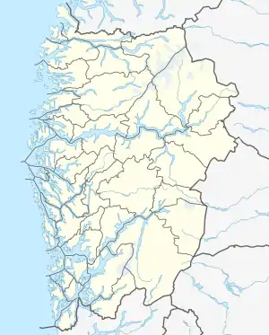 Fannaråki Location of the mountain  Fannaråki Fannaråki (Norway) | |
| Location | Luster, Vestland, Norway |
| Parent range | Hurrungane |
| Topo map | 1518 III Sygnefjell |
Name
The first element is derived from the word fonn which means "glacier made of snow" and the last element is the finite form of råk which means "mountain ridge".[1]
Guidebooks
- Dyer, Anthony; Baddeley, John; Robertson, Ian H. (2006). Walks and Scrambles in Norway. Rockbuy Limited. ISBN 978-1-904466-25-3.
- Pollmann, Bernhard (2000). Norway South: Rother Walking Guide. Bergverlag Rudolf Rother. ISBN 978-3-7633-4807-7.
- Baxter, James. Scandinavian Mountains and Peaks Over 2000 Metres in the Hurrungane. Edinburgh: Scandinavian Publishing. ISBN 978-0-9550497-0-5.
References
- Store norske leksikon. "Fannaråki" (in Norwegian). Retrieved 2010-09-11.
This article is issued from Wikipedia. The text is licensed under Creative Commons - Attribution - Sharealike. Additional terms may apply for the media files.