Fannrem
Fannrem is a village in the municipality of Orkland in Trøndelag county, Norway. The village is located along the Orkla River about 5 kilometres (3.1 mi) south of the urban area of Orkanger, Thamshavn, and Råbygda, and about 9 kilometres (5.6 mi) north of the village of Vormstad.
Fannrem | |
|---|---|
Village | |
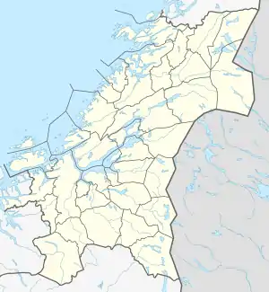
 Fannrem Location of the village  Fannrem Fannrem (Norway) | |
| Coordinates: 63.2665°N 09.8158°E | |
| Country | Norway |
| Region | Central Norway |
| County | Trøndelag |
| District | Orkdalen |
| Municipality | Orkland |
| Area | |
| • Total | 6.26 km2 (2.42 sq mi) |
| Elevation | 16 m (52 ft) |
| Population (2018 / combined with Orkanger)[1] | |
| • Total | 8,204 |
| • Density | 1,311/km2 (3,400/sq mi) |
| Time zone | UTC+01:00 (CET) |
| • Summer (DST) | UTC+02:00 (CEST) |
| Post Code | 7320 Fannrem |
Due to recent conurbation between Orkanger and Fannrem, Statistics Norway regards Orkanger-Fannrem as one 6.26-square-kilometre (2.42 sq mi) community with a population (2018) of 8,204. Orkanger-Fannrem is one of the largest settlements in Trøndelag county.[1][3]
Fannrem was the administrative centre of the old Orkdal municipality until 1 January 1963, when the municipalities of Orkanger, Orkland, and Geitastrand were merged into a new Orkdal municipality. At that time Orkanger became the municipal center.
The main city center of Fannrem is mainly composed of service industries, surrounded by residential areas and farms. The large Orkel industrial factory is located in Fannrem, which produces machinery for agricultural use. Norgesfôr Orkla, the main grain mill and silo for the Orkdalen region is located in Fannrem. Orkdal Church is located in Fannrem.
Notable residents
References
- Statistisk sentralbyrå (1 January 2018). "Urban settlements. Population and area, by municipality".
- "Fannrem, Orkdal (Trøndelag)". yr.no. Retrieved 2018-02-05.
- Store norske leksikon. "Fannrem" (in Norwegian). Retrieved 2011-01-28.