Florida State Road 526
State Road 526 (SR 526) is a 3.306-mile-long (5.320 km) east–west route in the Orlando, Orange County. It runs from State Road 50 in Ocoee, to State Road 15, the frontage roads of State Road 408, in Orlando. After the western terminus of SR 526, State Road 50, it becomes SR 439. Between US 441 and the western terminus, it is known as County Road 526, and locally known as Old Winter Garden Road. It crosses State Road 408 twice. At the overpass of Interstate 4, State Road 526 runs north–south for 1 block. It then heads into Downtown Orlando via Robinson Street and follows the northern shore of Lake Eola. SR 526 next intersects State Road 15. At the Orlando Executive Airport, it heads north–south and then ends at State Road 15, the frontage roads of State Road 408.
| ||||
|---|---|---|---|---|
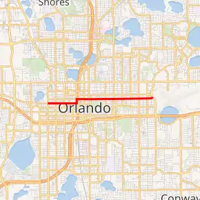
SR 526 highlighted in red | ||||
| Route information | ||||
| Maintained by FDOT | ||||
| Length | 3.306 mi[1] (5.320 km) | |||
| Major junctions | ||||
| West end | ||||
| East end | Crystal Lake Drive in Orlando | |||
| Location | ||||
| Counties | Orange | |||
| Highway system | ||||
| ||||


Major intersections
The entire route is in Orlando, Orange County.
| mi[1] | km | Destinations | Notes | ||
|---|---|---|---|---|---|
| 0.000 | 0.000 | Road is unsigned SR 500 / SR 600 | |||
| 0.913 | 1.469 | Access via frontage roads | |||
| 1.223 | 1.968 | ||||
| 1.414 | 2.276 | ||||
| 2.118 | 3.409 | ||||
| 3.306 | 5.320 | Maguire Boulevard north / Crystal Lake Drive south | |||
| 1.000 mi = 1.609 km; 1.000 km = 0.621 mi | |||||
References
- FDOT straight line diagrams Archived March 6, 2014, at the Wayback Machine, accessed January 2014