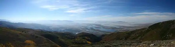
Francis Peak
Francis Peak, Elevation 9,560 feet (2,910 m), was named in honor of an early pioneer, Esther Charlotte Emily Weisbrodt Francis,[3] who contributed to the colonization of the Morgan Valley in Morgan county in Utah. One of the taller peaks of the Wasatch Range, Francis Peak is located on the border between Morgan and Davis counties, approximately 18 miles (29 km) north of Salt Lake City, Utah, United States.
| Francis Peak | |
|---|---|
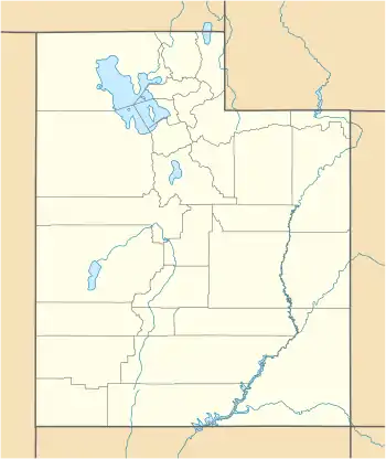 Francis Peak Location in Utah | |
| Highest point | |
| Elevation | 9524+ ft (2903+ m) NAVD 88[1] |
| Prominence | 500 feet (152 m) [1] |
| Coordinates | 41°01′59″N 111°50′18″W [2] |
| Geography | |
| Location | Davis County, Utah, U.S. |
| Parent range | Wasatch Range |
| Topo map | USGS Peterson |
The summit is accessible by hiking, biking, recreational vehicles, and automobile. Automobiles can access the peak via Skyline Drive in Bountiful and Farmington Canyon Road in Farmington. Camping sites, trails, small ponds, wildlife and great vistas are part of this rugged natural setting.
Elevation Dispute
U.S. Geological Survey lists Francis Peak as 9,547 feet above sea level. However, that was before the 1950s construction adding two radar domes. The natural height there now is 9,515 feet. The base of the radar facility adds 55 feet and the domes chip in 60 feet more for a total extra artificial height of 115 feet and a grand total of 9,630 feet above sea level.[4]
See also
References
- "Francis Peak, Utah". Peakbagger.com. Retrieved 2016-04-18.
- "Francis Peak". Geographic Names Information System. United States Geological Survey. Retrieved 2016-04-18.
- Utah State History Markers and Monuments
- http://www.standard.net/Ogden-Area-History-Bin/2014/07/31/Francis-Peak-Remote-Davis-Morgan-County-outpost