Gévora (river)
The Gévora (Portuguese pronunciation: [ˈʒɛvuɾɐ]) or Xévora River is a tributary of the Guadiana, in the southwest of the Iberian Peninsula. It runs through both Portugal and Spain.[n. 2]
| Gévora | |
|---|---|
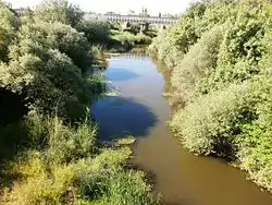
 The Gévora close to its mouth | |
| Native name | Xévora (in Portuguese) Gévora (in Spanish) |
| Location | |
| Country | Portugal, Spain |
| Physical characteristics | |
| Source | |
| • location | Serra de São Mamede |
| • coordinates | 39°18′47″N 7°21′38″W |
| • elevation | 1,027 m (3,369 ft) |
| Mouth | |
• location | Guadiana |
• coordinates | 38°53′31″N 6°57′53″W |
| Length | 73.81 km (45.86 mi) |
| Discharge | |
| • location | Foronomic station #4255 (Badajoz)[n. 1] |
| • average | 9.13 m3/s |
| • minimum | 0.26 m3/s |
| • maximum | 37.78 m3/s |
It has its source in the Serra de São Mamede (Portugal), at 1,027 metres above sea level.[3][2] Featuring a total length of 73.81 km,[4] the river, running initially roughly from west to east, takes a southern turn in Spain, eventually emptying into the Guadiana near Badajoz.
Some of its main left-bank tributaries are the Jola, Guarranque and Zapatón, while its right-bank tributaries include the Gevorete, Codosero and Abrilongo.[2]
References
Informational notes
- Roughly 3 kilometre upstream from the river mouth. Data for the 1969–2014 period.[1]
- It crosses the Portugal–Spain border three times.[2]
Citations
- "Estación 4255. Río Gévora en Badajoz". Centro de Estudios y Experimentación de Obras Públicas.
- Extremadura, El Periódico. "Gévora: el río superviviente". El Periódico Extremadura (in Spanish). Retrieved 2020-01-15.
- Urquiaga Cela, Raúl; Martín Barajas, Santiago; González Briz, Erika (2015). Reservas Naturales Fluviales. Propuesta de nuevas reservas naturales fluviales en la Cuenca del Guadiana (PDF). Madrid: Libros en Acción. p. 35. ISBN 978-84-943183-8-2.
- "Análisis Territorial de Valencia de Alcántara" (PDF). Diputación Provincial de Cáceres. p. 27.
This article is issued from Wikipedia. The text is licensed under Creative Commons - Attribution - Sharealike. Additional terms may apply for the media files.