Georgia State Route 308
State Route 308 (SR 308) is a northwest-southeast state highway located in the southwest part of the U.S. state of Georgia. Its route is entirely within Sumter County.
| ||||
|---|---|---|---|---|
 | ||||
| Route information | ||||
| Maintained by GDOT | ||||
| Length | 11.4 mi[1] (18.3 km) | |||
| Major junctions | ||||
| West end | ||||
| East end | ||||
| Location | ||||
| Counties | Sumter | |||
| Highway system | ||||
| ||||

Route description
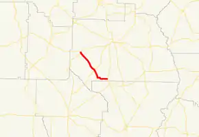
SR 308 begins at an intersection with SR 45 in the southwestern part of Plains. The route heads southeast out of the city along South Bond Street. It continues southeast through rural portions of the county, passing Salters Mill Road. Farther along, it has an intersection with SR 49. The highway continues southeast, and then turns easterly until it meets its eastern terminus, an intersection with US 19/SR 3 northwest of Smithville.
Major intersections
The entire route is in Sumter County.
| Location | mi[1] | km | Destinations | Notes | |
|---|---|---|---|---|---|
| Plains | 0.0 | 0.0 | Western terminus; SR 45 south runs along Botsford Road; SR 45 north runs along South Bond Street. | ||
| | 6.4 | 10.3 | |||
| | 11.4 | 18.3 | |||
| | 11.4 | 18.3 | Eastern terminus | ||
| 1.000 mi = 1.609 km; 1.000 km = 0.621 mi | |||||
See also
.svg.png.webp) Georgia (U.S. state) portal
Georgia (U.S. state) portal U.S. roads portal
References
- Google (February 8, 2013). "Route of SR 308" (Map). Google Maps. Google. Retrieved February 8, 2013.
External links
This article is issued from Wikipedia. The text is licensed under Creative Commons - Attribution - Sharealike. Additional terms may apply for the media files.