Germagnat
Germagnat is a former commune in the Ain department in eastern France. On 1 January 2017, it was merged into the new commune Nivigne et Suran.[2]
Germagnat | |
|---|---|
Part of Nivigne et Suran | |
Location of Germagnat 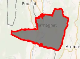
| |
 Germagnat  Germagnat | |
| Coordinates: 46°18′41″N 5°26′57″E | |
| Country | France |
| Region | Auvergne-Rhône-Alpes |
| Department | Ain |
| Arrondissement | Bourg-en-Bresse |
| Canton | Saint-Étienne-du-Bois |
| Commune | Nivigne et Suran |
| Area 1 | 9.48 km2 (3.66 sq mi) |
| Population (2017)[1] | 144 |
| • Density | 15/km2 (39/sq mi) |
| Time zone | UTC+01:00 (CET) |
| • Summer (DST) | UTC+02:00 (CEST) |
| Postal code | 01250 |
| Elevation | 319–761 m (1,047–2,497 ft) (avg. 344 m or 1,129 ft) |
| 1 French Land Register data, which excludes lakes, ponds, glaciers > 1 km2 (0.386 sq mi or 247 acres) and river estuaries. | |
Population
| Year | Pop. | ±% |
|---|---|---|
| 2006 | 133 | — |
| 2007 | 140 | +5.3% |
| 2008 | 144 | +2.9% |
| 2009 | 145 | +0.7% |
| 2010 | 145 | +0.0% |
| 2011 | 146 | +0.7% |
| 2012 | 147 | +0.7% |
| 2013 | 149 | +1.4% |
| 2014 | 147 | −1.3% |
| 2015 | 144 | −2.0% |
| 2016 | 142 | −1.4% |
See also
References
- Téléchargement du fichier d'ensemble des populations légales en 2017, INSEE
- Arrêté préfectoral 20 May 2016 (in French)
| Wikimedia Commons has media related to Germagnat. |
This article is issued from Wikipedia. The text is licensed under Creative Commons - Attribution - Sharealike. Additional terms may apply for the media files.