German Bight
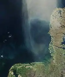
The German Bight (German: Deutsche Bucht; Danish: tyske bugt; Dutch: Duitse bocht; West Frisian: Dútske bocht; North Frisian: Schiisk Bocht; sometimes also the German Bay) is the southeastern bight of the North Sea bounded by the Netherlands and Germany to the south, and Denmark and Germany to the east (the Jutland peninsula). To the north and west it is limited by the Dogger Bank. The Bight contains the Frisian and Danish Islands. The Wadden Sea is approximately ten to twelve kilometres wide at the location of the German Bight.[1] The Frisian islands and the nearby coastal areas are collectively known as Frisia. The southern portion of the bight is also known as the Heligoland Bight. Between 1949 and 1956 the BBC Sea Area Forecast (Shipping Forecast) used "Heligoland" as the designation for the area now referred to as German Bight.
%252C_Elbe%252C_Trischen.jpg.webp)
References
Further reading
- George Drower (2011). Heligoland: The True Story of German Bight. The History Press.