Germignonville
Germignonville is a former commune in the Eure-et-Loir department in northern France. On 1 January 2016, it was merged into the new commune of Éole-en-Beauce.[2]
Germignonville | |
|---|---|
Part of Éole-en-Beauce | |
Location of Germignonville 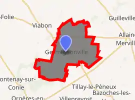
| |
 Germignonville  Germignonville | |
| Coordinates: 48°11′36″N 1°44′13″E | |
| Country | France |
| Region | Centre-Val de Loire |
| Department | Eure-et-Loir |
| Arrondissement | Chartres |
| Canton | Voves |
| Commune | Éole-en-Beauce |
| Area 1 | 20.92 km2 (8.08 sq mi) |
| Population (2017)[1] | 223 |
| • Density | 11/km2 (28/sq mi) |
| Time zone | UTC+01:00 (CET) |
| • Summer (DST) | UTC+02:00 (CEST) |
| Postal code | 28140 |
| Elevation | 117–141 m (384–463 ft) (avg. 141 m or 463 ft) |
| 1 French Land Register data, which excludes lakes, ponds, glaciers > 1 km2 (0.386 sq mi or 247 acres) and river estuaries. | |
Population
| Year | Pop. | ±% |
|---|---|---|
| 1962 | 228 | — |
| 1968 | 292 | +28.1% |
| 1975 | 264 | −9.6% |
| 1982 | 223 | −15.5% |
| 1990 | 199 | −10.8% |
| 1999 | 185 | −7.0% |
| 2008 | 240 | +29.7% |
References
| Wikimedia Commons has media related to Germignonville. |
| Authority control |
|
|---|
This article is issued from Wikipedia. The text is licensed under Creative Commons - Attribution - Sharealike. Additional terms may apply for the media files.