Gilgal, Bik'at HaYarden
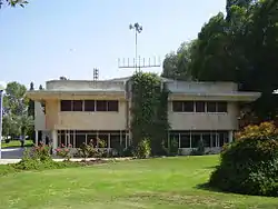
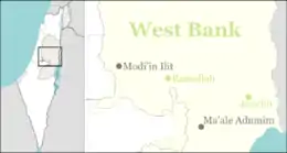
Gilgal (Hebrew: גִּלְגָּל) is an Israeli settlement organized as a kibbutz in the West Bank.[2] Located in the Jordan Valley around 16 kilometres north of Jericho with an area of 1,400 dunams, it falls under the jurisdiction of Bik'at HaYarden Regional Council.[3] In 2019 it had a population of 203.
Gilgal | |
|---|---|
 | |
 Gilgal | |
| Coordinates: 31°59′58.81″N 35°26′39.86″E | |
| District | Judea and Samaria Area |
| Council | Bik'at HaYarden |
| Region | West Bank |
| Affiliation | Kibbutz Movement |
| Founded | 1970 |
| Founded by | Nahal |
| Population (2019)[1] | 203 |
The international community considers Israeli settlements in the West Bank illegal under international law, but the Israeli government disputes this.[4]
History
Gilgal was established in 1970 as a Nahal settlement, and was named for the ancient Biblical site of Gilgal,[5] which is thought to have been located at Khirbat al-Mafjar, two kilometres north-east of Jericho[6] and better known as the site of the Umayyads' Hisham's Palace. According to ARIJ, in order to construct Gilgal, Israel confiscated land in 1970 from two Palestinian villages: 858 dunams from Fasayil,[7] and 268 dunams from Al-Auja.[8] It was converted to a civilian kibbutz in 1973.[6]
Economy
Gilgal has invested millions of dollars in state-of-the-art water technology to boost its production of medjool dates. The system is based on the utilization of wastewater.[9]
Climate
| Climate data for Gilgal (-255m) | |||||||||||||
|---|---|---|---|---|---|---|---|---|---|---|---|---|---|
| Month | Jan | Feb | Mar | Apr | May | Jun | Jul | Aug | Sep | Oct | Nov | Dec | Year |
| Record high °C (°F) | 28.0 (82.4) |
33.5 (92.3) |
40.5 (104.9) |
44.7 (112.5) |
46.5 (115.7) |
47.5 (117.5) |
48.1 (118.6) |
49.0 (120.2) |
45.7 (114.3) |
44.2 (111.6) |
37.9 (100.2) |
32.5 (90.5) |
49.0 (120.2) |
| Average high °C (°F) | 20.1 (68.2) |
21.6 (70.9) |
25.6 (78.1) |
30.3 (86.5) |
35.6 (96.1) |
38.7 (101.7) |
40.4 (104.7) |
40.0 (104.0) |
37.7 (99.9) |
33.8 (92.8) |
27.7 (81.9) |
22.1 (71.8) |
31.1 (88.1) |
| Daily mean °C (°F) | 14.5 (58.1) |
15.5 (59.9) |
18.7 (65.7) |
22.8 (73.0) |
27.3 (81.1) |
30.5 (86.9) |
32.4 (90.3) |
32.5 (90.5) |
30.5 (86.9) |
26.9 (80.4) |
21.1 (70.0) |
16.4 (61.5) |
24.1 (75.4) |
| Average low °C (°F) | 8.9 (48.0) |
9.4 (48.9) |
11.8 (53.2) |
15.3 (59.5) |
19.1 (66.4) |
22.3 (72.1) |
24.5 (76.1) |
25.0 (77.0) |
23.2 (73.8) |
19.9 (67.8) |
14.4 (57.9) |
10.6 (51.1) |
17.0 (62.7) |
| Record low °C (°F) | 0.3 (32.5) |
0.0 (32.0) |
2.5 (36.5) |
3.0 (37.4) |
11.2 (52.2) |
15.2 (59.4) |
20.0 (68.0) |
19.5 (67.1) |
14.0 (57.2) |
12.1 (53.8) |
4.6 (40.3) |
0.2 (32.4) |
0.0 (32.0) |
| Source: Israel Meteorological Service[10] | |||||||||||||
See also
References
- "Population in the Localities 2019" (XLS). Israel Central Bureau of Statistics. Retrieved 16 August 2020.
- We're Building Time Magazine
- Settlements Bik'at HaYarden Regional Council
- "The Geneva Convention". BBC News. 10 December 2009. Retrieved 27 November 2010.
- Carta's Official Guide to Israel and Complete Gazetteer to all Sites in the Holy Land. (3rd edition 1993) Jerusalem, Carta, p.167, ISBN 965-220-186-3 (English)
- Hela Crown-Tamir (2000) How to Walk in the Footsteps of Jesus and the Prophets: A Scripture Reference Guide for Biblical Sites in Israel and Jordan, Gefen Publishing House Ltd
- Fasayil Village Profile p. 17, ARIJ
- Al 'Auja Town Profile p. 19, ARIJ
- Medjool Dates From Israel Wastewater Proving Favorite of Foodies Bloomberg
- "Averages and Records for several places in Israel" (PDF). Israel Meteorological Service. January 2016. Archived from the original (PDF) on 2016-01-30.
