Glonn (Amper)
Glonn is a river of Upper Bavaria, Bavaria, Germany.
| Glonn | |
|---|---|
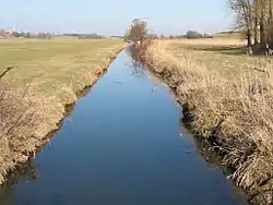 The Glonn at Taxa, a district of Odelzhausen | |
| Location | |
| Country | Germany |
| State | Bavaria |
| Physical characteristics | |
| Source | |
| • location | at Mittelstetten |
| • elevation | about 525 metres (1,722 ft) |
| Mouth | |
• location | at Allershausen into the Amper |
• coordinates | 48.4331°N 11.6039°E |
• elevation | about 440 metres (1,440 ft) |
| Length | 51.7 km (32.1 mi) [1] |
| Basin size | 405 km2 (156 sq mi) [1] |
| Basin features | |
| Progression | Amper→ Isar→ Danube→ Black Sea |
The Glonn is 51.7 kilometres (32.1 mi) long.[1] It rises southeast of Mittelstetten in the district of Fürstenfeldbruck. It is the main tributary of the Amper; at Allershausen near Freising it discharges from the left into the Amper.
The Glonn flows through an agriculturally used area in the triangle between Augsburg, Freising and Dachau. Larger places in its course are Odelzhausen, Erdweg, Markt Indersdorf, Weichs, Petershausen and Hohenkammer.
Tributaries
- Kollbach
- Röhrersbach (left)
- Tegernbach (left)
- Rettenbach (left)
- Schweinbach (right)
- Umbach (left)
- Rohrbach (right)
- Steinfurter Bach (left)
- Steindlbach (right)
- Zeitlbach (left)
- Riensbach (right)
- Dorfbach (right)
- Eichhofner Bach or Albersbach, resp. (left)
- Rothbach (right)
- Gittersbach (left)
- Langenpettenbach (left)
- Ebersbach
- Klausnerbach
See also
References
- Complete table of the Bavarian Waterbody Register by the Bavarian State Office for the Environment (xls, 10.3 MB)
This article is issued from Wikipedia. The text is licensed under Creative Commons - Attribution - Sharealike. Additional terms may apply for the media files.