Gobbler Formation
The Gobbler Formation is a geologic formation in the Sacramento Mountains of New Mexico.[1] It preserves fossils dating back to the Moscovian Age of the Pennsylvanian Period.[2]
| Gobbler Formation Stratigraphic range: Moscovian | |
|---|---|
| Type | Formation |
| Underlies | Beeman Formation |
| Overlies | Lake Valley Limestone |
| Thickness | 1,200–1,600 ft (370–490 m) |
| Lithology | |
| Primary | Limestone, sandstone, shale |
| Other | Conglomerate |
| Location | |
| Coordinates | 32.83°N 105.905°W |
| Region | New Mexico |
| Country | United States |
| Type section | |
| Named for | Gobbler (dome and triangulation station) |
| Named by | L.C. Pray |
| Year defined | 1954 |
 Gobbler Formation (the United States) 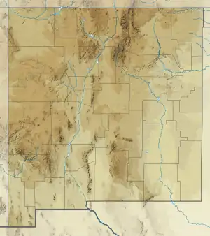 Gobbler Formation (New Mexico) | |
Description
The Gobbler Formation consists of a lower section of 200–500 feet (61–152 m) of quartz sandstone and limestone and an upper section of over 1,000 feet (300 m) of shales and quartz sandstones. The lower sandstone beds are well-sorted and the limestone includes black masses of chert. These beds intruded by sills possibly of Tertiary age.[3][4] The upper beds interfinger with limestone assigned to the Bug Scuffle Limestone Member of the Gobbler Formation. The total thickness is 1,200–1,600 feet (370–490 m).[3] The formation overlies the Lake Valley Limestone, from which it is separated by a subaerial erosion surface with paleochannels as deep as 100 feet (30 m)[2] The Gobbler Formation underlies the Beeman Formation.[3]
The Bug Scuffle Limestone Member contains parasequences 3–20 meters (9.8–65.6 ft) thick whose uppermost beds show isotopic evidence of subaerial exposure.[5][6]
The formation is prominently exposed at Oliver Lee Memorial State Park, where the Bug Scuffle Member forms prominent cliffs.[7]
Fossils
The sandstone beds locally contain plant fossils. The Bug Scuffle Limestone Member is mostly sparsely fossiliferous, with occasional local concentrations of a variety of fossils including bryozoans, corals, crinoids, coralline algae, and foraminifera.[3] These include the crinoids Lecythiocrinus and Paragassizocrinus.[8] The base of the formation contains earliest Morrowan (Bashkirian) conodonts.[9]
History of investigation
The unit was first named by Pray in 1954[1] and a type section was designated in 1961.[3]
Footnotes
- Pray 1954
- Kues and Giles 2004
- Pray 1961
- Asquith 1973
- Algeo et al. 1992
- Algeo 1996
- McLemore 1996
- Strimple 1980
- Lane 1974
References
- Algeo, Thomas J. (1996). "Meteoric water/rock ratios and the significance of sequence and parasequence boundaries in the Gobbler Formation (middle Pennsylvanian) of south-central New Mexico". Geological Society of America Special Paper. 306: 359–371. ISBN 9780813723068. Retrieved 19 September 2020.
- Algeo, Thomas J.; Wilkinson, Bruce H.; Lohmann, Kyger C. (1992). "Meteoric-burial Diagenesis of Middle Pennsylvanian Limestones in the Orogrande Basin, New Mexico: Water/Rock Interactions and Basin Geothermics". SEPM Journal of Sedimentary Research. 62. doi:10.1306/D426797E-2B26-11D7-8648000102C1865D.
- Asquith, George B. (1 April 1973). "High-Viscosity 'Conglomerate' Channel Deposits in Tertiary Lamprophyre Sill, Sacramento Mountains, New Mexico". Geology. 1 (4): 149–151. Bibcode:1973Geo.....1..149A. doi:10.1130/0091-7613(1973)1<149:HCCDIT>2.0.CO;2.
- Kues, B.S.; Giles, K.A. (2004). "The late Paleozoic Ancestral Rocky Mountain system in New Mexico". In Mack, G.H.; Giles, K.A. (eds.). The geology of New Mexico. A geologic history: New Mexico Geological Society Special Volume 11. pp. 95–136. ISBN 9781585460106.
- Lane, H. Richard (1974). "Mississippian of Southeastern New Mexico and West Texas--A Wedge-on-Wedge Relation". AAPG Bulletin. 58. doi:10.1306/83D913D0-16C7-11D7-8645000102C1865D.
- McLemore, Virginia T. (February 1996). "Oliver Lee Memorial" (PDF). New Mexico Geology. 18 (1): 14–17. Retrieved 19 September 2020.
- Pray, L.C. (1954). "Outline of the stratigraphy and structure of the Sacramento Mountain escarpment [Otero County, New Mexico]" (PDF). New Mexico Geological Society Field Conference Guidebook. 5: 92–107. Retrieved 29 July 2020.
- Pray, L.C. (1961). "Geology of the Sacramento Mountains Escarpment, Otero County, New Mexico". New Mexico Bureau of Mines and Mineral Resources Bulletin. 35. Retrieved 30 July 2020.
- Strimple, H. L. (1980). "Pennsylvanian Crinoids from Sangre de Cristo and Sacramento Mountains of New Mexico" (PDF). New Mexico Bureau of Mines & Mineral Resources Circular. 178. Retrieved 19 September 2020.