Grésivaudan
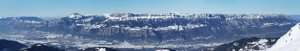
The Grésivaudan (sometimes Graisivaudan) is a valley of the French Alps, situated mostly in the Isère. Etymologically, Graisivaudan comes from roots meaning "Grenoble" (Gratianopolis) and "valley".[1] It comprises the alluvial plain of the river Isère from Grenoble to the confluence of the Arc; or, more recently, the entire valley of the Isère from Tullins to Albertville. The stretch from Tullins to Grenoble is the Bas-Grésivaudan (Lower Grésivaudan) and that between Grenoble and Albertville is the Haut-Grésivaudan (Upper Grésivaudan).
Climate
The Grésivaudan valley is right on the boundary between the humid continental climate and the oceanic climate under the Köppen system. Winters are cold and moderately snowy, while summers are hot and slightly drier.
| Climate data for Crolles, Isère, France, Alt. : 239 m, (1982-2012) | |||||||||||||
|---|---|---|---|---|---|---|---|---|---|---|---|---|---|
| Month | Jan | Feb | Mar | Apr | May | Jun | Jul | Aug | Sep | Oct | Nov | Dec | Year |
| Average high °C (°F) | 5.6 (42.1) |
8.1 (46.6) |
13.4 (56.1) |
16.5 (61.7) |
20.5 (68.9) |
24.0 (75.2) |
26.7 (80.1) |
25.8 (78.4) |
22.4 (72.3) |
16.6 (61.9) |
10.6 (51.1) |
5.9 (42.6) |
16.3 (61.4) |
| Daily mean °C (°F) | 1.6 (34.9) |
3.4 (38.1) |
7.8 (46.0) |
10.9 (51.6) |
14.7 (58.5) |
18.1 (64.6) |
20.3 (68.5) |
19.6 (67.3) |
16.8 (62.2) |
11.7 (53.1) |
6.6 (43.9) |
2.4 (36.3) |
11.2 (52.2) |
| Average low °C (°F) | −2.4 (27.7) |
−1.2 (29.8) |
2.2 (36.0) |
5.4 (41.7) |
9.0 (48.2) |
12.3 (54.1) |
14.0 (57.2) |
13.5 (56.3) |
11.3 (52.3) |
6.9 (44.4) |
2.7 (36.9) |
−1.0 (30.2) |
6.1 (42.9) |
| Average precipitation mm (inches) | 59 (2.3) |
66 (2.6) |
72 (2.8) |
66 (2.6) |
78 (3.1) |
75 (3.0) |
53 (2.1) |
72 (2.8) |
78 (3.1) |
78 (3.1) |
85 (3.3) |
67 (2.6) |
849 (33.4) |
| Source: http://en.climate-data.org/ | |||||||||||||
References
- Robert des noms propres (in French)