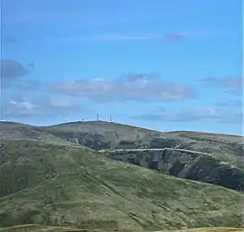
Green Lowther
Green Lowther is a hill in the Lowther Hills range, part of the Southern Uplands of Scotland. It is the highest point of the Lowther Hills and lies in Lanarkshire, east of the town of Sanquhar. A microwave array once stood at the summit, however a telecommunications mast remains next to a transmitter station.[4] The private service road which makes its way up neighbouring Lowther Hill, continuing over Green Trough to the summit is the second highest paved road in Britain after Great Dun Fell in the Pennines and the highest road of any kind in Scotland.[5]
| Green Lowther | |
|---|---|
 | |
| Highest point | |
| Elevation | 732 m (2,402 ft) [1] |
| Prominence | 424 m (1,391 ft) [2] |
| Listing | Ma,Hu,Tu,Sim, G, D,DN,Y[3] |
| Coordinates | 55°23′24″N 3°44′15″W |
| Geography | |
| Location | South Lanarkshire, Scotland |
| Parent range | Lowther Hills, Southern Uplands |
| OS grid | NS 90037 12027 |
| Topo map | OS Landranger 71, 78 |
References
- "Green Lowther". hill-bagging.co.uk. Retrieved 28 October 2019.
- http://www.hill-bagging.co.uk/mountaindetails.php?qu=S&rf=1740
- http://www.hills-database.co.uk/database_notes.html#classification
- Green Lowther: BT Microwave Sites
- https://roadcyclinguk.com/sportive/13-highest-roads-ride-uk.html
- http://www.hills-database.co.uk/database_notes.html#classification
- https://www.hill-bagging.co.uk/mountaindetails.php?qu=S&rf=1763
This article is issued from Wikipedia. The text is licensed under Creative Commons - Attribution - Sharealike. Additional terms may apply for the media files.