Greys Peak
Greys Peak is the northernmost summit of the East Humboldt Range of Elko County in northeastern Nevada about 10 miles (16 km) southwest of the community of Wells. It rises over 5,000 feet (1,500 m) from the Humboldt Valley, making it one of the most visually prominent peaks in the area. To the west are Dennis Flats, Starr Valley, and remote Greys Lake, while to the east are Chimney Rock, Clover Valley, and popular Angel Lake. The summit is the start of a high crest running almost 10 miles (16 km) to the south.
| Greys Peak | |
|---|---|
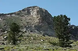 Greys Peak, looking northwest | |
| Highest point | |
| Elevation | 10,676 ft (3,254 m) NAVD 88[1] |
| Prominence | 714 ft (218 m) [2] |
| Coordinates | 41°01′26″N 115°06′17″W [1] |
| Geography | |
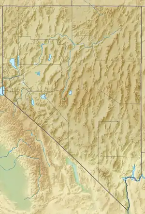 Greys Peak Elko County, Nevada, U.S. | |
| Parent range | East Humboldt Range |
| Topo map | USGS Welcome |
| Climbing | |
| Easiest route | Scramble, class 2[3] |
The peak is named after Enoch Grey, an early homesteader in nearby Starr Valley.
Climbing
The most common approach starts at the Angel Lake Campground on the mountains western flank. A primitive trail, (class 2), climbs about 2,300 feet (700 m) from the parking lot.[3]
References
- "Grays". NGS data sheet. U.S. National Geodetic Survey. Retrieved 2008-11-22.
- "Greys Peak". Peakbagger.com. Retrieved 2011-05-17.
- "Greys Peak". SummitPost.org. Retrieved 2011-05-17.
External links
- "Greys Peak". Geographic Names Information System. United States Geological Survey. Retrieved 2008-11-22.