Guernsey, Saskatchewan
Guernsey is an organized hamlet within the Rural Municipality of Usborne No. 310[1] in the Canadian province of Saskatchewan. It previously held village status until it dissolved in 2005.
Guernsey | |
|---|---|
Organized hamlet | |
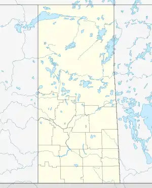
 Location of Guernsey in Saskatchewan  Guernsey, Saskatchewan (Canada) | |
| Coordinates: 51°52′12″N 105°11′13″W | |
| Country | Canada |
| Province | Saskatchewan |
| Region | Saskatchewan |
| Census division | 11 |
| Rural municipality (RM) | Usborne No. 310 |
| Dissolved | December 31, 2005 |
| Government | |
| • Governing body | RM of Usborne No. 318 |
| Area | |
| • Total | 0.68 km2 (0.26 sq mi) |
| Population (2006) | |
| • Total | 88 |
| • Density | 129.1/km2 (334/sq mi) |
| Time zone | CST |
| Area code(s) | 306 |
| Highways | Highway 20 |
History
Prior to December 31, 2005, Guernsey was incorporated as a village, and dissolved becoming under the jurisdiction of the Rural Municipality of Usborne No. 310.[2]
Demographics
| Canada census – Guernsey, Saskatchewan community profile | |||
|---|---|---|---|
| 2006 | |||
| Population: | 88 (-18.5% from 2001) | ||
| Land area: | 0.68 km2 (0.26 sq mi) | ||
| Population density: | 129.1/km2 (334/sq mi) | ||
| Median age: | 50.8 (M: 55.0, F: 47.5) | ||
| Total private dwellings: | 45 | ||
| Median household income: | $32592 | ||
| References: 2006[3] earlier[4] | |||
Climate
| Climate data for Guernsey | |||||||||||||
|---|---|---|---|---|---|---|---|---|---|---|---|---|---|
| Month | Jan | Feb | Mar | Apr | May | Jun | Jul | Aug | Sep | Oct | Nov | Dec | Year |
| Record high °C (°F) | 7 (45) |
8 (46) |
15 (59) |
30 (86) |
37.8 (100.0) |
40 (104) |
37.5 (99.5) |
36.5 (97.7) |
33 (91) |
29.5 (85.1) |
21.1 (70.0) |
8.2 (46.8) |
40 (104) |
| Average high °C (°F) | −11 (12) |
−8 (18) |
−1.5 (29.3) |
10.7 (51.3) |
18.5 (65.3) |
22.8 (73.0) |
25.3 (77.5) |
24 (75) |
17.4 (63.3) |
10.5 (50.9) |
−1.7 (28.9) |
−9.5 (14.9) |
8.1 (46.6) |
| Daily mean °C (°F) | −16.5 (2.3) |
−13.3 (8.1) |
−6.7 (19.9) |
4.3 (39.7) |
11.6 (52.9) |
16 (61) |
18.5 (65.3) |
16.9 (62.4) |
10.9 (51.6) |
4.3 (39.7) |
−6.4 (20.5) |
−14.4 (6.1) |
2.1 (35.8) |
| Average low °C (°F) | −21.9 (−7.4) |
−18.5 (−1.3) |
−11.9 (10.6) |
−2.1 (28.2) |
4.6 (40.3) |
9.1 (48.4) |
11.6 (52.9) |
9.7 (49.5) |
4.3 (39.7) |
−1.9 (28.6) |
−11 (12) |
−19.3 (−2.7) |
−3.9 (25.0) |
| Record low °C (°F) | −42.8 (−45.0) |
−42 (−44) |
−36.1 (−33.0) |
−28.3 (−18.9) |
−8 (18) |
−1.5 (29.3) |
4 (39) |
−2.5 (27.5) |
−7.5 (18.5) |
−22.5 (−8.5) |
−35.5 (−31.9) |
−43 (−45) |
−43 (−45) |
| Average precipitation mm (inches) | 14.9 (0.59) |
12.4 (0.49) |
18.1 (0.71) |
20.4 (0.80) |
49 (1.9) |
62.8 (2.47) |
66.8 (2.63) |
47.8 (1.88) |
41.2 (1.62) |
19.3 (0.76) |
13.2 (0.52) |
16.5 (0.65) |
382.1 (15.04) |
| Source: Environment Canada[5] | |||||||||||||
See also
References
- "2019-2020 Rural Revenue Sharing Organized Hamlet Grant". Government of Saskatchewan. Retrieved May 8, 2020.
- "Restructured Villages". Saskatchewan Ministry of Municipal Affairs. Archived from the original on March 25, 2008. Retrieved February 10, 2008.
- "2006 Community Profiles". 2006 Canadian Census. Statistics Canada. March 30, 2011. Retrieved February 24, 2009.
- "2001 Community Profiles". 2001 Canadian Census. Statistics Canada. February 17, 2012.
- Environment Canada Canadian Climate Normals 1971–2000, accessed 27 July 2010
This article is issued from Wikipedia. The text is licensed under Creative Commons - Attribution - Sharealike. Additional terms may apply for the media files.