Gusla Peak
Gusla Peak (Bulgarian: връх Гусла, romanized: vrah Gusla, IPA: [ˈvrɤɣ ˈɡusɫɐ]) is the peak rising to 1200 m in the southeast foothills of Detroit Plateau on Nordenskjöld Coast in Graham Land, Antarctica, at the NNW extremity of a narrow 3.9 km long rocky ridge surmounting Desudava Glacier to the north and east, Mundraga Bay to the southeast, and Boryana Glacier to the south.
The peak is named after the settlement of Gusla in Northeastern Bulgaria.
Location
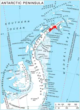
Gusla Peak is located at 64°25′56″S 60°14′25″W, which 4.88 km south-southwest of Kavlak Peak, 8.02 km west-southwest of Mount Elliott, 9.77 km northeast of Batkun Peak, and 24.63 km east-southeast of Baldwin Peak on Danco Coast. British mapping in 1978.
Maps
- British Antarctic Territory. Scale 1:200000 topographic map. DOS 610 Series, Sheet W 64 60. Directorate of Overseas Surveys, UK, 1978.
- Antarctic Digital Database (ADD). Scale 1:250000 topographic map of Antarctica. Scientific Committee on Antarctic Research (SCAR), 1993–2016.
References
- Gusla Peak. SCAR Composite Antarctic Gazetteer.
- Bulgarian Antarctic Gazetteer. Antarctic Place-names Commission. (details in Bulgarian, basic data in English)
External links
- Gusla Peak. Copernix satellite image
This article includes information from the Antarctic Place-names Commission of Bulgaria which is used with permission.