Gutsal Ridge
Gutsal Ridge (Bulgarian: Гуцалски хребет, ‘Gutsalski Hrebet’ \'gu-tsal-ski 'hre-bet\) is the ice-covered ridge extending 10.4 km in northwest-southeast direction and rising to 1600 m on the southeast side of Stribog Mountains on Brabant Island in the Palmer Archipelago, Antarctica. The southeast half of the ridge has steep and partly ice-free southwest slopes. It surmounts Hippocrates Glacier to the southwest and Balanstra Glacier to the northeast.
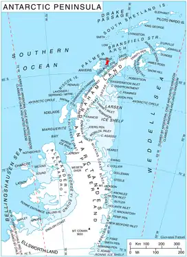
Location of Brabant Island in the Antarctic Peninsula region.
The ridge is named after the settlement of Gutsal in Western Bulgaria.
Location
Gutsal Ridge is centred at 64°20′25″S 62°20′40″W. British mapping in 1980 and 2008.
Maps
- Antarctic Digital Database (ADD). Scale 1:250000 topographic map of Antarctica. Scientific Committee on Antarctic Research (SCAR). Since 1993, regularly upgraded and updated.
- British Antarctic Territory. Scale 1:200000 topographic map. DOS 610 Series, Sheet W 64 62. Directorate of Overseas Surveys, Tolworth, UK, 1980.
- Brabant Island to Argentine Islands. Scale 1:250000 topographic map. British Antarctic Survey, 2008.
References
- Bulgarian Antarctic Gazetteer. Antarctic Place-names Commission. (details in Bulgarian, basic data in English)
- Gutsal Ridge. SCAR Composite Antarctic Gazetteer.
External links
- Gutsal Ridge. Copernix satellite image
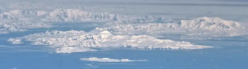
Brabant Island seen from northeast, with Anvers Island (on the right) and Antarctic Peninsula in the background; Stribog Mountains occupy most of the central and the right, near part of the island.
This article includes information from the Antarctic Place-names Commission of Bulgaria which is used with permission.
This article is issued from Wikipedia. The text is licensed under Creative Commons - Attribution - Sharealike. Additional terms may apply for the media files.