Hârtibaciu
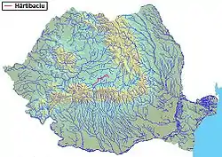
The Hârtibaciu (German: Harbach; Hungarian: Hortobágy) is a river in the Transylvania historical region of Romania. It develops in the South Carpathians and flows into the Cibin, a tributary of the Olt,[1][2] in Mohu, southeast of Sibiu. It flows through the towns and villages Bărcuț, Retiș, Brădeni, Netuș, Agnita, Benești, Alțâna, Nocrich, Hosman, Cornățel and Cașolț. Its length is 110 km (68 mi) and its basin size is 1,025 km2 (396 sq mi).[2]
| Hârtibaciu | |
|---|---|
 | |
| Location | |
| Country | Romania |
| Counties | Brașov, Sibiu |
| Towns | Agnita |
| Physical characteristics | |
| Mouth | Cibin |
• location | Mohu |
• coordinates | 45.7338°N 24.2379°E |
| Length | 110 km (68 mi) |
| Basin size | 1,025 km2 (396 sq mi) |
| Basin features | |
| Progression | Cibin→ Olt→ Danube→ Black Sea |
King Géza II of Hungary settled the initial Transylvanian Saxon colonists along the Hârtibaciu, referred to by them as the Harbach. The Saxons established many towns along the river such as Agnita with Kirchenburgen, or fortified churches.
Tributaries
The following rivers are tributaries to the river Hârtibaciu (from source to mouth):[2]
- Left: Valea Morii, Albac, Androchiel, Marpod, Fofeldea, Ghijasa
- Right: Sărătura, Halmer, Valea Comunală, Valea Satului, Valea Înfundăturii, Valea Stricată, Coveș, Bârghiș, Zlagna, Hârța, Vurpăr, Țichindeal, Lacul Roșia, Zăvoi, Daia, Cașolț
References
- "Planul național de management. Sinteza planurilor de management la nivel de bazine/spații hidrografice, anexa 7.1" (PDF, 5.1 MB). Administrația Națională Apele Române. 2010. p. 690.
- Atlasul cadastrului apelor din România. Partea 1 (in Romanian). Bucharest: Ministerul Mediului. 1992. pp. 289–291. OCLC 895459847. River code: VIII.1.120.11