Hårteigen
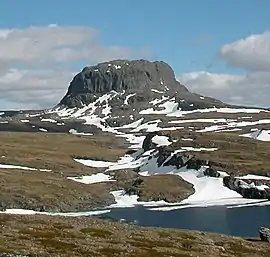
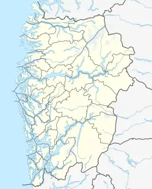
Hårteigen is a characteristic mountain in Vestland county, Norway. It sits on and is visible from most parts of the vast Hardangervidda plateau. The mountain is located in the municipality of Ullensvang, and it is inside the Hardangervidda National Park.[3]
| Hårteigen | |
|---|---|
 | |
| Highest point | |
| Elevation | 1,690 m (5,540 ft) |
| Prominence | 480 m (1,570 ft) [1] |
| Isolation | 27.64 to 27.66 km (17.17 to 17.19 mi) |
| Coordinates | 60.1931°N 7.0693°E[2] |
| Geography | |
 Hårteigen Location of the mountain  Hårteigen Hårteigen (Norway) | |
| Location | Vestland, Norway |
| Topo map | 1415 III Hårteigen |
| Climbing | |
| First ascent | 18 August 1812. Christen Smith, J. Fr. Schouw, and Nils Hertzberg |
| Easiest route | Steep ice/snow |
At an elevation of 1,690 metres (5,540 ft) above sea level, the peak of Hårteigen rises 480 metres (1,570 ft) above the surrounding plateau which is fairly level. It is located about 30 kilometres (19 mi) northeast of the town of Odda.
Name
The first element is from the Old Norse word hárr which means 'grey' and the last element is related to the German verb zeigen which means 'show'. On the large and flat plateau of Hardangervidda this mountain was important for travellers to find the direction.[3]
See also
References
| Wikimedia Commons has media related to Hårteigen. |
- Petter Bjørstad's mountain page
- "Hårteigen, Ullensvang (Vestland)" (in Norwegian). yr.no. Retrieved 2020-03-01.
- Store norske leksikon. "Hårteigen" (in Norwegian). Retrieved 2014-06-04.