Hörnli
Hörnli mountain is located on the territory of the community of Fischenthal, in the Zürcher Oberland, in the eastern part of canton of Zürich, in Switzerland. It is 1,133 meters (3,717 ft) high.
| Hörnli | |
|---|---|
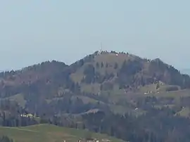 Hörnli as seen from Bachtel (March 2007) | |
| Highest point | |
| Elevation | 1,133 m (3,717 ft) |
| Prominence | 178 m (584 ft) |
| Coordinates | 47°22′16″N 8°56′16″E |
| Geography | |
 Hörnli Location in Switzerland | |
| Location | Zurich, Switzerland |
| Parent range | Swiss Prealps |
North of the Hörnli, the Dreiländerstein, altitude 992 meters (3,255 ft), marks the meeting of the boundaries of the three Cantons of Zürich, St.Gallen and Thurgau.
Already in the Middle Ages, the so-called Schwabenweg, led over the Hörnli, as a part of the Way of St. James. Since 2008, it is an integrated stretch of the Kreuzlingen branch on the Via Jacobi, registered on the official Swiss national trekking path nr. 4, signalled as leg Fischingen–Rapperswil on Wanderland Schweiz. [1]
Climate
| Climate data for Hörnli (1981-2010) | |||||||||||||
|---|---|---|---|---|---|---|---|---|---|---|---|---|---|
| Month | Jan | Feb | Mar | Apr | May | Jun | Jul | Aug | Sep | Oct | Nov | Dec | Year |
| Average high °C (°F) | 1.6 (34.9) |
1.6 (34.9) |
4.8 (40.6) |
9.3 (48.7) |
13.9 (57.0) |
17.0 (62.6) |
19.6 (67.3) |
18.8 (65.8) |
14.8 (58.6) |
10.9 (51.6) |
5.3 (41.5) |
2.3 (36.1) |
10.0 (50.0) |
| Daily mean °C (°F) | −0.9 (30.4) |
−0.8 (30.6) |
1.8 (35.2) |
5.1 (41.2) |
9.7 (49.5) |
12.7 (54.9) |
15.1 (59.2) |
14.9 (58.8) |
11.3 (52.3) |
7.8 (46.0) |
2.7 (36.9) |
0.0 (32.0) |
6.6 (43.9) |
| Average low °C (°F) | −3.4 (25.9) |
−3.2 (26.2) |
−0.7 (30.7) |
2.1 (35.8) |
6.5 (43.7) |
9.4 (48.9) |
11.8 (53.2) |
11.8 (53.2) |
8.6 (47.5) |
5.3 (41.5) |
0.4 (32.7) |
−2.4 (27.7) |
3.9 (39.0) |
| Average relative humidity (%) | 75 | 76 | 76 | 73 | 74 | 75 | 75 | 77 | 82 | 81 | 81 | 78 | 77 |
| Mean monthly sunshine hours | 90 | 96 | 122 | 141 | 161 | 174 | 212 | 195 | 150 | 120 | 81 | 67 | 1,608 |
| Source: MeteoSwiss [2] | |||||||||||||
References
- "Wanderland.ch". Archived from the original on 2011-03-12. Retrieved 2009-09-24.
- "Climate Norm Value Tables". Climate diagrams and normals from Swiss measuring stations. Federal Office of Meteorology and Climatology (MeteoSwiss). Archived from the original on 14 May 2013. Retrieved 23 January 2013. The weather station elevation is meters above sea level.
External links
| Wikimedia Commons has media related to Hörnli. |
This article is issued from Wikipedia. The text is licensed under Creative Commons - Attribution - Sharealike. Additional terms may apply for the media files.