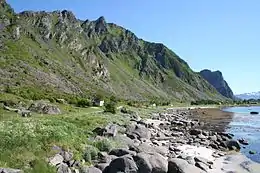
Hadseløya
Hadseløya or Hadseløy is an island in Hadsel Municipality in Nordland county, Norway. It is located in the Vesterålen region on the north side of the Hadselfjorden. The town of Stokmarknes is situated on the northern shore of the island and the village of Melbu is on the southern coast.
 | |
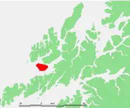 | |
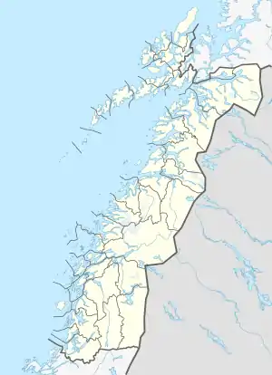 Hadseløya Location of the island  Hadseløya Hadseløya (Norway) | |
| Geography | |
|---|---|
| Location | Nordland, Norway |
| Coordinates | 68.5455°N 14.7009°E |
| Archipelago | Vesterålen |
| Area | 102 km2 (39 sq mi) |
| Length | 16 km (9.9 mi) |
| Width | 10 km (6 mi) |
| Highest elevation | 657 m (2156 ft) |
| Highest point | Lamlitind |
| Administration | |
Norway | |
| County | Nordland |
| Municipality | Hadsel Municipality |
The island has an area of 102 square kilometres (39 sq mi). The 657-metre (2,156 ft) tall mountain Lamlitind is the highest point on the island. Hadseløya is connected to the neighboring islands of Langøya and Børøya by the Hadsel Bridge. There is also a ferry connection from the village of Melbu to the village of Fiskebøl on Austvågøya island to the south.[1]
See also
References
- Store norske leksikon. "Hadseløya" (in Norwegian). Retrieved 2012-07-22.
This article is issued from Wikipedia. The text is licensed under Creative Commons - Attribution - Sharealike. Additional terms may apply for the media files.