Hundred of Duffield
The Hundred of Duffield is a cadastral unit of hundred located in the Australian state of South Australia within the County of MacDonnell and the state government region of the Limestone Coast about 210 kilometres (130 mi) south-east of the state capital of Adelaide and about 29 kilometres (18 mi) north of the municipal seat of Kingston SE.[1]
| Hundred of Duffield South Australia | |||||||||||||||
|---|---|---|---|---|---|---|---|---|---|---|---|---|---|---|---|
 | |||||||||||||||
 Hundred of Duffield | |||||||||||||||
| Coordinates | 36°34′11″S 139°53′29″E | ||||||||||||||
| LGA(s) | Kingston District Council[1] | ||||||||||||||
| Region | Limestone Coast [1] | ||||||||||||||
| County | MacDonnell[1] | ||||||||||||||
| |||||||||||||||
| Footnotes | Coordinates[2] Adjoining Hundreds[3] | ||||||||||||||
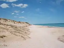
It is located on the Australian continental coastline overlooking the body of water known in Australia as the Southern Ocean and by international authorities as the Great Australian Bight.[4][5] Its extent includes part of the locality of Coorong on its western side while its eastern side is occupied by the locality of Taratap.[1]
History
The traditional owners of the land are the Ngarrindjeri. The hundred was proclaimed on 3 November 1864, but it wasn't until 1888 that local government administration was brought to the hundred when it was annexed by the District Council of Lacapede, later called Kingston council. A school opened in the area in 1912 but closed in 1916.[6]
References
- "Search result for 'Hundred of Duffield, HD' with the following datasets selected - 'Local Government areas', 'SA Government Regions', 'Hundreds', 'Counties' and '"Suburbs and Localities'". Retrieved 14 December 2017.
- "Search result for "Hundred of Duffield" (N.B. please select the info" button for coordinate information and the 'tools' button to measure distances)". Property Location Browser. Government of South Australia. Retrieved 14 December 2017.
- "HUNDRED MAP Series Index Map" (PDF). Department of Environment and Heritage, Government of South Australia. December 2008. Retrieved 14 December 2017.
- "Limits of Oceans and Seas, 3rd edition" (PDF) (PDF). International Hydrographic Organization. 1953. pp. 35–36. Archived from the original (PDF) on 8 October 2011. Retrieved 29 December 2020.
- "AHS – AA609582" (PDF) (PDF). The Australian Hydrographic Service. 5 July 2012. Retrieved 30 May 2013.
- Manning, Geoffrey. "South Australian Names - D" (PDF). Manning Index of South Australian History. State Library of South Australia. Retrieved 20 December 2017.