Hungry Run (South Branch French Creek tributary)
Hungry Run is a 3.49 mi (5.62 km) long tributary to South Branch French Creek in Erie County, Pennsylvania and is classed as a 2nd order stream on the EPA waters geoviewer site.[4]
| Hungry Run Tributary to South Branch French Creek | |
|---|---|
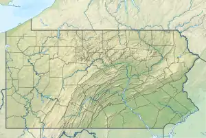 Location of Hungry Run mouth  Hungry Run (South Branch French Creek tributary) (the United States) | |
| Location | |
| Country | United States |
| State | Pennsylvania |
| Counties | Erie Crawford |
| Physical characteristics | |
| Source | divide between Hungry Run and Britton Run (Oil Creek) |
| • location | about 3 miles northeast of Tillotson, Pennsylvania[1] |
| • coordinates | 41°50′36″N 079°46′40″W[2] |
| • elevation | 1,645 ft (501 m)[1] |
| Mouth | South Branch French Creek |
• location | about 2 miles southwest of Elgin, Pennsylvania[1] |
• coordinates | 41°53′07″N 079°46′41″W[2] |
• elevation | 1,319 ft (402 m)[2] |
| Length | 3.49 mi (5.62 km)[3] |
| Basin size | 4.47 square miles (11.6 km2)[4] |
| Discharge | |
| • location | South Branch French Creek |
| • average | 9.00 cu ft/s (0.255 m3/s) at mouth with South Branch French Creek[4] |
| Basin features | |
| Progression | north |
| River system | Allegheny River |
| Tributaries | |
| • left | unnamed tributaries |
| • right | unnamed tributaries |
| Bridges | Hungry Run Road (x2), Concord Road |
Course
Hungry Run rises in Bloomfield Township of northern Crawford County and then flows north into Erie County through Union Township where it meets South Branch French Creek.
Watershed
Hungry Run drains 4.47 square miles (11.6 km2) of Erie Drift Plain (glacial geology). The watershed receives an average of 46.6 in/year of precipitation and has a wetness index of 469.09.[4]
Additional Images
.jpg.webp)
Course of Hungry Run (South Branch French Creek tributary)
.jpg.webp)
Watershed of Hungry Run (South Branch French Creek tributary)
References
- "Pine Run Topo Map, Erie County PA (Union City Area)". TopoZone. Locality, LLC. Retrieved 16 September 2019.
- "GNIS Detail – Hungry Run". geonames.usgs.gov. US Geological Survey. Retrieved 16 September 2019.
- "ArcGIS Web Application". epa.maps.arcgis.com. US EPA. Retrieved 16 September 2019.
- "Hungry Run Watershed Report". Waters Geoviewer. US EPA. Retrieved 16 September 2019.
This article is issued from Wikipedia. The text is licensed under Creative Commons - Attribution - Sharealike. Additional terms may apply for the media files.