Huwyl Burg
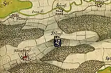
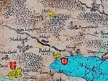
Huwyl Burg was a castle built between Römerswil and Hochdorf, nearby Lake Baldegg (Canton of Lucern, Switzerland). It was the stronghold of the family Huwyler. The castle is shown on the 1613 Lucern map by Cysat and Wägmann[1] the 1667 map by Hans Conrad Gyger of the area. However, it is not included in latter maps. Its ruins were excavated in 1902 and they can be visited.

1667 Hans Conrad Gyger Map

Lucern Canton Map by Cysat & Wägmann 1613
References
- Hans Heinrich, Wägmann. "Lucern Canton Archives". Lucen Map.
This article is issued from Wikipedia. The text is licensed under Creative Commons - Attribution - Sharealike. Additional terms may apply for the media files.