Idaho State Highway 28
State Highway 28 (SH-28) is a 135.645-mile-long (218.299 km) state highway in Idaho which runs from Idaho State Highway 33 (SH-33) near Mud Lake to U.S. Route 93 in Salmon. The entire length of the route is designated as the Sacajawea Historic Byway by the state of Idaho.[2]
| ||||
|---|---|---|---|---|
| Sacajawea Historic Byway | ||||
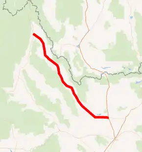
SH-28 highlighted in red | ||||
| Route information | ||||
| Maintained by ITD | ||||
| Length | 135.645 mi[1] (218.299 km) | |||
| Major junctions | ||||
| South end | ||||
| North end | ||||
| Highway system | ||||
| ||||

Route description
.jpg.webp)
Idaho State Highway 28 begins at an intersection with ID 33. The route heads northwest before passing the Mud Lake Airport, proceeding to an intersection with State Highway 22. After a long distance, it proceeds through the Lemhi Valley, bending north before curving northwest again for a short distance. The roadway passes the Leadore Airport on its way into Leadore, meeting Idaho State Highway 29 while in the community. Just after exiting the town, the road travels parallel to the Lemhi River for several miles before ending at U.S. Route 93 in the community of Salmon.[1]
Major junctions
| County | Location | mi[1] | km | Destinations | Notes | |||
|---|---|---|---|---|---|---|---|---|
| Jefferson | | 0.000 | 0.000 | Southern terminus; Sacajawea Historic Byway continues on SH-33 east 15.15 miles (24.38 km) to I-15 | ||||
| Butte |
No major junctions | |||||||
| Clark | | 15.460 | 24.880 | |||||
| Lemhi | Leadore | 75.079 | 120.828 | Southern terminus of SH-29; former SH-28 north | ||||
| Salmon | 120.495 | 193.918 | Northern terminus; highway continues as US-93 north (Main Street west) | |||||
| 1.000 mi = 1.609 km; 1.000 km = 0.621 mi | ||||||||
References
- "Milepost Log for Highway 28". Idaho Transportation Department. Archived from the original on 2012-05-12. Retrieved 2008-05-15.
- Idaho Transportation Department. "Sacajawea Scenic Byway". Idaho's Scenic Byways. America's Byways. Archived from the original on April 30, 2013. Retrieved January 29, 2013.
External links
![]() Media related to Idaho State Highway 28 at Wikimedia Commons
Media related to Idaho State Highway 28 at Wikimedia Commons