Idaho State Highway 71
State Highway 71 (SH-71) is a 28.790-mile-long (46.333 km) state highway, connecting the north–south U.S. Route 95 (US-95) corridor with the recreational opportunities in Hells Canyon. It runs north from Cambridge to the Oregon border at the Brownlee Dam.[1]
| ||||
|---|---|---|---|---|
SH-71 highlighted in red | ||||
| Route information | ||||
| Maintained by ITD | ||||
| Length | 28.790 mi[1] (46.333 km) | |||
| Major junctions | ||||
| North end | ||||
| South end | ||||
| Location | ||||
| Counties | Adams, Washington | |||
| Highway system | ||||
| ||||

Route description
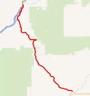
SH-71 begins on a bridge crossing the Snake River and the Oregon border. The road continues south, passing by Brownlee Dam and winding along the edge of the river. The highway turns inland, heading southeast and curving through the mountains. Eventually, SH-71 moves into farmland, and enters the town of Cambridge as Hopper Avenue, where it ends at US-95.[2]
Major intersections
| County | Location | mi[1] | km | Destinations | Notes | |||
|---|---|---|---|---|---|---|---|---|
| Baker | | Continuation into Oregon | ||||||
| Snake River | 0.000 | 0.000 | Oregon–Idaho state line | |||||
| Adams |
No major junctions | |||||||
| Washington | Cambridge | 28.790 | 46.333 | |||||
| 1.000 mi = 1.609 km; 1.000 km = 0.621 mi | ||||||||
References
- "Highway Milepost Log". Idaho Transportation Department. 2011-08-30. Archived from the original on 2012-05-12. Retrieved 2012-05-04.
- Google (20 July 2012). "State Highway 71" (Map). Google Maps. Google. Retrieved 20 July 2012.
External links
This article is issued from Wikipedia. The text is licensed under Creative Commons - Attribution - Sharealike. Additional terms may apply for the media files.