Illinois Route 60
Illinois Route 60 (IL 60) is a 17.22-mile-long (27.71 km) east–west state highway in Lake County, in northeastern Illinois. It connects the village of Volo at Illinois Route 120 (Belvidere Road) just east of Illinois Route 59 with the city of Lake Forest at U.S. Highway 41 (Skokie Highway).[1]
| ||||
|---|---|---|---|---|
| Town Line Road Kennedy Road | ||||
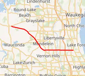
IL 60 highlighted in red | ||||
| Route information | ||||
| Maintained by IDOT | ||||
| Length | 17.22 mi[1] (27.71 km) | |||
| Existed | February 1967[2]–present | |||
| Major junctions | ||||
| West end | ||||
| East end | ||||
| Location | ||||
| Counties | Lake | |||
| Highway system | ||||
| ||||

Route description
Illinois 60 overlaps with Illinois Route 83 south of Ivanhoe where Illinois 83 curves around U.S. Route 45. It is called Town Line Road east of Illinois 83 and west of the Tri-State Tollway (Interstate 94), because Illinois 60 straddles the line separating Vernon and Libertyville Townships for most of its length. Through Lake Forest to the east, Route 60 is called Kennedy Road.
Route 60, especially the portion between Milwaukee Avenue and Interstate 94 in Mettawa, experiences unusually heavy traffic for an arterial road, although less so in recent years.
History
SBI Route 60 was the current U.S. Route 12 from the Wisconsin state line to Chicago.[3] This was dropped in 1938.[4] In February 1967, IL 60 was brought back to replace IL 59A as part of replacing some superfluous designations.[2] In 1972, Illinois 60 was removed east of U.S. 41 due to the decommissioning of IL 42.[5]
Major intersections
The entire route is in Lake County.
| Location | mi | km | Destinations | Notes | |
|---|---|---|---|---|---|
| Volo | 0.00 | 0.00 | Western terminus of IL 60 | ||
| Mundelein | 6.7 | 10.8 | Western end of concurrency with IL 83 | ||
| 6.8 | 10.9 | ||||
| Vernon Hills | 10.2 | 16.4 | Eastern end of concurrency with IL 83 | ||
| 10.5 | 16.9 | ||||
| 13.1 | 21.1 | ||||
| Mettawa | 15.3 | 24.6 | I-94 exit 19 | ||
| Lake Forest | 16.8 | 27.0 | |||
| 17.22 | 27.71 | Eastern terminus of IL 60 | |||
1.000 mi = 1.609 km; 1.000 km = 0.621 mi
| |||||
References
- Illinois Technology Transfer Center (2006). "T2 GIS Data". Retrieved November 8, 2007.
- "Route Numbers to be Changed". The Daily Sentinel. February 7, 1967. p. 8. Retrieved May 7, 2018 – via Newspapers.com.

- Illinois Secretary of State; Rand McNally (1936). Road Map Illinois (Map). [c. 1:950,000 and c. 1:1,110,000]. Springfield: Illinois Secretary of State – via Illinois Digital Archives.
- Illinois Secretary of State; Rand McNally (1939). Illinois Road Map (Map) (1939–1940 ed.). c. 1:918,720. Springfield: Illinois Secretary of State – via Illinois Digital Archives.
- Illinois Department of Transportation (1972). Illinois Official Highway Map (Map). [1:772,500]. Springfield: Illinois Department of Transportation – via Illinois Digital Archives.