Illinois Route 70
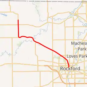
Illinois Route 70 is a state road in far north-central Illinois. It runs from Illinois Route 75 in Durand to Business U.S. Route 20 in Rockford. This is a distance of 19.01 miles (30.59 km).[1]
| ||||
|---|---|---|---|---|
| Trask Bridge Road | ||||
IL 70 highlighted in red | ||||
| Route information | ||||
| Maintained by IDOT | ||||
| Length | 19.01 mi[1][2] (30.59 km) | |||
| Existed | 1924[3]–present | |||
| Major junctions | ||||
| South end | ||||
| North end | West Howard Street/Oak Street in Durand | |||
| Location | ||||
| Counties | Winnebago | |||
| Highway system | ||||
| ||||

Route description
Illinois 70 is the main route northwest of Rockford, and is called Kilburn Avenue and Trask Bridge Road in this area. The route serves mainly rural areas and consists of two-lane undivided surface street for its entire length.
History
SBI Route 70 ran from Durand to Rockford to Mendota, located about 60 miles (97 km) south of Rockford. In 1940, U.S. Route 51 replaced Illinois 70 from Mendota to Rockford, and Illinois 70 was pulled back to its current intersection with what was then U.S. 20.[3]
Major intersections
The entire route is in Winnebago County.
| Location | mi[1][2] | km | Destinations | Notes | |
|---|---|---|---|---|---|
| Rockford | 0.00 | 0.00 | Southern terminus | ||
| | 17.9 | 28.8 | |||
| Durand | 19.01 | 30.59 | West Howard Street/Oak Street | Northern terminus[4] | |
| 1.000 mi = 1.609 km; 1.000 km = 0.621 mi | |||||
References
- Illinois Technology Transfer Center (2006). "T2 GIS Data". Illinois Department of Transportation. Retrieved November 8, 2007.
- Google (September 20, 2020). "Overview map of Illinois Route 70" (Map). Google Maps. Google. Retrieved September 20, 2020.
- Carlson, Rich (March 15, 2005). "Routes 61 thru 80". Illinois Highways Page. Retrieved April 12, 2006.
- Google (September 20, 2020). "Street view of the northern terminus of IL 70" (Map). Google Maps. Google. Retrieved September 20, 2020.
This article is issued from Wikipedia. The text is licensed under Creative Commons - Attribution - Sharealike. Additional terms may apply for the media files.