Indre Øksningan
Indre Øksningan (Inner Øksningan)[1] is an island in the municipality of Herøy in Nordland county, Norway. Together with Ytre Øksningan, it is part of the Øksningan archipelago. The island has an area of 2.3 square kilometers (0.89 sq mi) and a population of 78 (2016). It is connected to the rest of Herøy by the Kalvøyrevet Bridge and Norwegian County Road 166.[2]
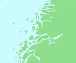 | |
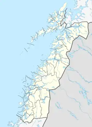 Indre Øksningan Location of the island  Indre Øksningan Indre Øksningan (Norway) | |
| Geography | |
|---|---|
| Location | Nordland, Norway |
| Coordinates | 65.9933°N 12.2304°E |
| Archipelago | Øksningan |
| Area | 2.3 km2 (0.89 sq mi) |
| Length | 3.25 km (2.019 mi) |
| Width | 1.4 km (0.87 mi) |
| Highest elevation | 57.5 m (188.6 ft) |
| Highest point | Matmorhågjen |
| Administration | |
Norway | |
| County | Nordland |
| Municipality | Herøy Municipality |
| Demographics | |
| Population | 78 (2016) |
See also
References
- "About Herøy". Herøy-Helgeland. Retrieved October 16, 2017.
- Thorsnæs, Geir, ed. (2016-03-23). "Øksningan". Store norske leksikon (in Norwegian). Kunnskapsforlaget. Retrieved 2019-02-19.
This article is issued from Wikipedia. The text is licensed under Creative Commons - Attribution - Sharealike. Additional terms may apply for the media files.