Iruña de Oca/Iruña Oka
Iruña de Oca (Basque: Iruña Oka) is a municipality located in the province of Álava, in the Basque Country, northern Spain. Is compounded by five towns called "concejos" which names are:
- Nanclares de la Oca/Langraiz Oka (is the capital of the municipality)
- Montevite/Mandaita
- Ollávarre/Olabarri
- Víllodas/Billoda
- Trespuentes/Trasponde
Iruña de Oka / Iruña Oka
Iruña Oka (in Basque) Iruña de Oca (in Spanish) | |
|---|---|
| Iruña Oka / Iruña de Oca | |
 Flag .svg.png.webp) Coat of arms | |
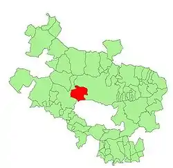 Location of Iruña Oka in Álava | |
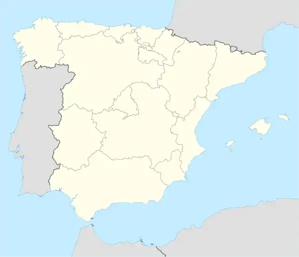 Iruña de Oka / Iruña Oka Location in Spain | |
| Coordinates: 42°49′09″N 2°48′46″W | |
| Country | Spain |
| Autonomous community | Basque Country |
| Province | Araba/Álava |
| Eskualdea / Cuadrilla | Cuadrilla de Añana |
| Founded | In 1976 |
| Government | |
| • Mayor | Miguel Ángel Montes Sánchez (PSE-EE) |
| Area | |
| • Total | 53.25 km2 (20.56 sq mi) |
| Elevation | 500 m (1,600 ft) |
| Population (2019) | |
| • Total | 3,411 |
| • Density | 64/km2 (170/sq mi) |
| Demonym(s) | Iruñaokar, iruñar (in Basque) |
| Time zone | UTC+1 (CET) |
| • Summer (DST) | UTC+2 (CEST) |
| Postal code | 01230 |
| Official language(s) | Spanish, Basque |
| Website | Official website |
It was formed in 1976 by the merger of the municipalities of Iruña (Trespuentes and Víllodas) and Nanclares de la Oca (Montevite, Ollávarre and Nanclares).
Iruña de Oca is the most populated municipality of the Cuadrilla de Añana. More than the 35% of the people of Añana live there.
It is located in the central part of the Álava province, just 14 km far from Vitoria, the capital city of the Basque Country.
This article is issued from Wikipedia. The text is licensed under Creative Commons - Attribution - Sharealike. Additional terms may apply for the media files.