Iskhodnaya
Iskhodnaya (Russian: Исходная), is a mountain in the Chantal Range. Administratively it is part of the Chukotka Autonomous Okrug, Russian Federation.
| Iskhodnaya | |
|---|---|
| Исходная | |
 Iskhodnaya | |
| Highest point | |
| Elevation | 1,887 m (6,191 ft) [1] |
| Coordinates | 67°48′59″N 178°17′19″E |
| Geography | |
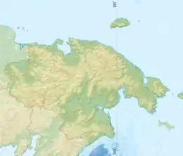
| Location | Chukotka Autonomous Okrug, Russian Far East |
| Parent range | Chantal Range, Chukotka Mountains |
Geography
This 1,775 m (5,823 ft) high mountain is the highest point of the Chukotka Mountains, part of the East Siberian System of ranges.[1] It rises just above the northern bank of the high course of the Chantalvergyrgyn River.[2]
The height of the summit is 1,887 metres (6,191 ft) according to the Great Soviet Encyclopedia.[1] According to other sources it is 1,843 metres (6,047 ft) high.[3][4] The same mountain is marked as a 6,081-foot-high (1,853 m) peak in the C-8 sheet of the Defense Mapping Agency Navigation charts. The same map shows another peak that is 6,047-foot-high (1,843 m), just a short distance to the west in the same ridge of the Chantal Range.[5]
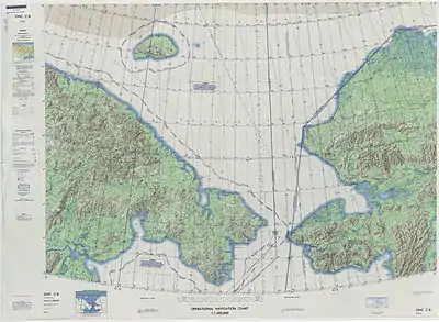 Defense Mapping Agency topographical map of the Chukchi Sea, 1973 |
See also
References
- Chukchi Highlands / Great Russian Encyclopedia; in 35 vol.] / Ch. ed. Yu.S. Osipov . – M .: Great Russian Encyclopedia, 2004—2017.
- Google Earth
- Czukockie, Góry – Encyklopedia PWN – źródło wiarygodnej i rzetelnej wiedzy, encyklopedia.pwn.pl
- Wielka Encyklopedia Gór i Alpinizmu, tom 2 Góry Azji, Katowice: Wydawnictwo STAPIS, 2005, ISBN 83-88212-42-7.
- 1,000,000 scale Operational Navigation Chart; Sheet C-8