Joch Pass
The Joch Pass (German: Jochpass) is a mountain pass of the Uri Alps, located between the Bernese Oberland and Central Switzerland, at the foot of the Titlis. The pass crosses the col between the peaks of Graustock and Jochstock, at an elevation of 2,207 m (7,241 ft) and at the border between the cantons of Bern and Nidwalden.[1]
| Joch Pass | |
|---|---|
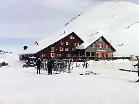 The Berggasthaus at the Joch Pass in winter | |
| Elevation | 2,207 m (7,241 ft) |
| Traversed by | Track or trail |
| Location | Bern/Nidwalden, Switzerland |
| Range | Uri Alps |
| Coordinates | 46°46′42″N 08°23′12″E |
 Joch Pass Location in Switzerland | |
The pass is traversed by a mule track, now used by hikers and mountain bikers, which connects the town of Engelberg, in the canton of Obwalden and at an elevation of 1,000 m (3,300 ft), with the town of Meiringen, in the canton of Bern and at an elevation of 595 m (1,952 ft). The track forms part of the Alpine Pass Route, a long-distance hiking trail across Switzerland between Sargans and Montreux.[1][2]
References
- map.geo.admin.ch (Map). Swiss Confederation. Retrieved 2015-05-14.
- Reynolds, Kev (2011). "Trek 10 - Alpine Pass Route". Trekking in the Alps. Cicerone. pp. 124–135. ISBN 978 1 85284 600 8.
External links
 Media related to Joch Pass at Wikimedia Commons
- Joch Pass on Via Alpina web site
- Jochpass on Hikr web site
This article is issued from Wikipedia. The text is licensed under Creative Commons - Attribution - Sharealike. Additional terms may apply for the media files.