K-149 (Kansas highway)
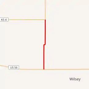
K-149 is a 6.098-mile-long (9.814 km) north–south state highway in the U.S. state of Kansas. K-149's southern terminus is at U.S. Route 56 (US-56) east of Delavan and the northern terminus is at K-4 south of White City.[3] Before state highways were numbered in Kansas there were Auto trails, the southern terminus follows the former National Old Trails Road, Old Santa Fe Trail and South West Trail. K-149 was first designated a state highway on February 13, 1957.[2]
| ||||
|---|---|---|---|---|
K-149 highlighted in red | ||||
| Route information | ||||
| Maintained by KDOT | ||||
| Length | 6.098 mi[1] (9.814 km) | |||
| Existed | February 13, 1957[2]–present | |||
| Major junctions | ||||
| South end | ||||
| North end | ||||
| Location | ||||
| Counties | Morris | |||
| Highway system | ||||
| ||||

Route description
K-149 begins at an intersection with US-56, about 12.8 miles (20.6 km) west of Council Grove, and begins traveling northward through rural grasslands. After roughly .6 miles (0.97 km) the highway passes through a small forested area at the crossing of an unnamed creek then transitions back to grasslands and intersects T Avenue. The highway continues north for two miles (3.2 km) then curves to the east at Q Avenue. K-149 continues for about 0.1 miles (0.16 km) the curves back to the north. From here it continues north for roughly 0.7 miles (1.1 km) and crosses the West Fork Neosho River, a tributary of the Neosho River. It continues north for about .6 miles (0.97 km) then passes by an abandoned schoolhouse. From here it continues north for another roughly 1.5 miles (2.4 km) through flat rural farmlands before reaching its northern terminus at K-4, about 3.2 miles (5.1 km) south of White City.[3]
The Kansas Department of Transportation (KDOT) tracks the traffic levels on its highways, and in 2017, they determined that on average the traffic was 175 vehicles per day on K-149.[4] K-149 is not included in the National Highway System.[5] The National Highway System is a system of highways important to the nation's defense, economy, and mobility.[6] The entire route is paved with partial design bituminous pavement.[7][8]
History
Before state highways were numbered in Kansas there were Auto trails, which were an informal network of marked routes that existed in the United States and Canada in the early part of the 20th century. The southern terminus follows the former National Old Trails Road, Old Santa Fe Trail and South West Trail.[9]
K-149 was first designated a state highway by the Kansas State Highway Commission, now known as KDOT, on February 13, 1957. K-149's alignment has not changed since it was created.[2]
Major intersections
The entire route is in Morris County.
| Location | mi[1] | km | Destinations | Notes | |
|---|---|---|---|---|---|
| Township 7 | 0.000 | 0.000 | Southern terminus | ||
| Township 6 | 6.098 | 9.814 | Northern terminus | ||
| 1.000 mi = 1.609 km; 1.000 km = 0.621 mi | |||||
References
- Staff (2016). "Pavement Management Information System". Kansas Department of Transportation. Retrieved April 16, 2017.
- State Highway Commission of Kansas (February 13, 1957). "Resolution for Addition to State Highway System Morris County K-149". Topeka: State Highway Commission of Kansas. Retrieved August 22, 2019.
- Highway Planning Department (2012). Morris County (PDF) (Map). Scale not given. General Highway Map. Topeka: Kansas Department of Transportation. Retrieved August 26, 2019.
- Bureau of Transportation Planning (2018). Traffic Flow Map Kansas State Highway System (PDF) (Map). [c. 1:1,584,000]. Topeka: Kansas Department of Transportation. Retrieved July 29, 2019.
- Federal Highway Administration (May 8, 2019). National Highway System: Kansas (PDF) (Map). [c. 1:3,900,000]. Federal Highway Administration. Retrieved July 29, 2019.
- Natzke, Stefan; Neathery, Mike; Adderly, Kevin (September 26, 2012). "What is the National Highway System?". National Highway System. Federal Highway Administration. Retrieved July 29, 2019.
- Staff (2012-07-19). "Pavement Management Information System Query". Kansas Department of Transportation. Retrieved 2013-01-22.
- Staff (2012-05-09). "Pavement Management Information System Glossary". Kansas Department of Transportation. Missing or empty
|url=(help) - Rand McNally and Company (1924). "Kansas" (Map). AutoTrails Map, Southern Nebraska, Eastern Colorado, Kansas, Northeastern New Mexico, Northern Oklahoma. 1:1,600,000. Chicago: Rand McNally and Company. OCLC 2078375. Retrieved August 17, 2020 – via Rumsey Collection.