K-268 (Kansas highway)
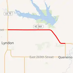
K-268 is a 9.490-mile-long (15.273 km) east–west state highway in the U.S. state of Kansas. K-268's western terminus is at U.S. Route 75 (US-75) and K-31 north of Lyndon, and the eastern terminus is at K-68 north of Quenemo.[3] K-268 was first designated a state highway in 1962 to connect Pomona State Park to the State Highway System.[2]
| ||||
|---|---|---|---|---|
K-268 highlighted in red | ||||
| Route information | ||||
| Maintained by KDOT | ||||
| Length | 9.490 mi[1] (15.273 km) | |||
| Existed | November 14, 1962[2]–present | |||
| Major junctions | ||||
| West end | ||||
| East end | ||||
| Location | ||||
| Counties | Osage | |||
| Highway system | ||||
| ||||

Route description
K-268 begins at an intersection with US-75 and K-31 north of Lyndon and travels east for roughly 2.5 miles (4.0 km) and intersects Rural Secondary 1471 (RS-1471), which travels south to K-68. From here it continues east for roughly 1 mile (1.6 km) and intersects RS-262, which travels north to Pomona State Park. It continies east another one mile (1.6 km) and intersects K-368, a short spur that also travels north to the state park. From K-368 it continues east for another roughly 1.6 miles (2.6 km) and intersects South Pomona Dam Road, which crosses the dam of Pomona Lake. At this point it begins to curve to a southeast direction. It travels southeast for roughly 2.5 miles (4.0 km) then curves back east. It continues east for approximately 0.6 miles (0.97 km) and reaches its eastern terminus at K-68 north of Quenemo.[3]
The Kansas Department of Transportation (KDOT) tracks the traffic levels on its highways, and in 2017, they determined that on average the traffic varied from 2450 vehicles per day slightly west of the terminus with K-368 to 2910 vehicles per day near the western terminus.[4] K-268 is not included in the National Highway System.[5] The National Highway System is a system of highways important to the nation's defense, economy, and mobility. K-268 does connect to the National Highway System at its terminus with US-75.[6] The entire route is paved with full design bituminous pavement.[1][7]
History
The U.S. Army Corps of Engineers began to construct Pomona Dam and its associated reservoir in the early 1960s. The federal agency agreed to relocate several county highways that would be displaced by the reservoir, and the Kansas State Highway Commission requested a pair of those highways–an east–west highway between US-75 and K-68 and an access road to the recreational land around the reservoir—be constructed to state highway standards. Then in a November 14, 1962 resolution, K-268 was approved from US-75 to K-68 south of the lake. Also at this time, K-368 was approved as a short spur from K-268 to link it to the recreation area by the lake.[2]
The former western terminus was a four-way intersection, and from January 2004 to August 2009, there was a total of 24 crashes, which included one fatality and fifteen that resulted in injuries. Residents of the surrounding communities requested a "safer type of intersection", then in late Fall of 2013, work began to reconstruct the intersection as a roundabout.[8][9] On November 17, 2014, the new roundabout at the eastern terminus opened to unrestricted traffic. The project was fully completed by the end of December. Smoky Hill LLC from Salina, was the primary contractor on the $2.541 million roundabout project.[10] On August 9, 2018, a tractor-trailer travelling southbound on US-75 crashed into the roundabout. The trucks fuel tank was damaged and spilled about 70 gallons of diesel fuel. K-31 and US-75 traffic was reduced to one lane for about four hours after the crash.[11]
Major intersections
The entire route is in Osage County.
| Location | mi[1] | km | Destinations | Notes | |
|---|---|---|---|---|---|
| Valley Brook Township | 0.000 | 0.000 | Western terminus; roundabout | ||
| Junction Township | 4.516 | 7.268 | Southern terminus of K-368 | ||
| Agency Township | 9.490 | 15.273 | Eastern terminus | ||
| 1.000 mi = 1.609 km; 1.000 km = 0.621 mi | |||||
References
- Staff (2016). "Pavement Management Information System". Kansas Department of Transportation. Retrieved April 16, 2017.
- State Highway Commission of Kansas (November 14, 1962). "Resolution for Addition of Roads to State Highway System". Topeka: State Highway Commission of Kansas. Retrieved September 1, 2019.
- KDOT (2007). 2007 Osage County Map (PDF) (Map). Scale not given. Topeka: KDOT. Retrieved September 1, 2019.
- Bureau of Transportation Planning (2018). Traffic Flow Map Kansas State Highway System (PDF) (Map). [c. 1:1,584,000]. Topeka: Kansas Department of Transportation. Retrieved July 29, 2019.
- Federal Highway Administration (May 8, 2019). National Highway System: Kansas (PDF) (Map). [c. 1:3,900,000]. Federal Highway Administration. Retrieved July 29, 2019.
- Natzke, Stefan; Neathery, Mike; Adderly, Kevin (September 26, 2012). "What is the National Highway System?". National Highway System. Federal Highway Administration. Retrieved July 29, 2019.
- Staff (2012-05-09). "Pavement Management Information System Glossary". Kansas Department of Transportation. Missing or empty
|url=(help) - Kansas Department of Transportation. "Kansas Roundabout Guide, Second Addition Appendices - KDOT". Topeka: Kansas Department of Transportation. Retrieved August 29, 2020.
- "US 75 and K-31/K-268 Roundabout Project open house Thursday". Emporia: The Emporia Gazzette. September 18, 2013. Retrieved August 27, 2020.
- White, Wayne (November 17, 2014). "U.S. 75 and K-31/K-268 roundabout now open from all directions". Lyndon: Osage County News. Retrieved August 27, 2020.
- Samples, Chuck (August 9, 2018). "UPDATE: Semi wreck almost totally closes roundabout connecting three Osage County highways". KVOE.com. Retrieved August 29, 2020.