Kakat Lake
Kakat Lake (also known as Kakat Mitatut Lake) is a glacial lake at the confluence of Holt Lake and Mistik Creek, approximately 21 kilometres (13 mi) northeast of Bakers Narrows. As a segment of the Mistik Creek, it is part of the Nelson River watershed, in the Hudson Bay drainage basin in the Northern Region of Manitoba, Canada. The surrounding mixed deciduous and coniferous forest is part of the Churchill River Upland portion of the Midwestern Canadian Shield forests.[1] The region around the lake consists of rocky parallel ridges with poorly drained areas of muskeg and irregular stony shorelines due to intense glaciation.[2] The lake is situated on the well known "Mistik Creek Loop", a remote canoe route 95 kilometres (59 mi) in length which can be paddled in four days.[3][4]
| Kakat Mitatut Lake | |
|---|---|
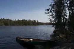 Stony shores of Kakat Mitatut Lake | |
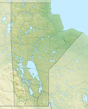 Kakat Mitatut Lake Location of Kakat Lake in Manitoba | |
| Location | Manitoba |
| Coordinates | 54°47′26″N 101°23′2″W |
| Lake type | Glacial Lake |
| Native name | Kakat Lake |
| Primary inflows | Mistik Creek, Holt Lake |
| Primary outflows | Mistik Creek |
| Basin countries | Canada |
| Max. length | 0.8 km (0.50 mi) |
| Max. width | 0.5 km (0.31 mi) |
| Surface elevation | 320 m (1,050 ft) |
| Islands | 3 |
Etymology
Kakat is Cree for "nine".[5] It is notable for being one of fourteen lakes on Mistik Creek named in numeric order in Cree.[1] The fourteen lakes listed by their Cree names with the English translations in order from south to north are:
- Payuk Lake - One (outflow)
- Neso Lake - Two
- Nisto Lake - Three
- Nao Lake - Four
- Niyanun Lake - Five
- Nikotwasik Lake - Six
- Tapukok Lake - Seven
- Uyenanao Lake - Eight
- Kakat Lake - Nine
- Mitatut Lake - Ten
- Payukosap Lake - Eleven
- Nesosap Lake - Twelve
- Nistosap Lake - Thirteen
- Naosap Lake - Fourteen (source)[5]
See also
References
- Manitoba Conservation and Water Stewardship (Summer 2012). Neso Lake Provincial Park Draft Management Plan (PDF). Manitoba Conservation and Water Stewardship. p. 2.
- Lee, Eun (2000). "Temporal Distribution of Ectomycorrhizzal Fungi and Pollen" (PDF). Korean Journal of Ecology. 23 (2): 169–173. Retrieved 18 May 2014.
- Schick, RoseAnna (2003-06-21). "Live the song of the paddles". Winnipeg Free Press. Retrieved 18 May 2014.
- Berard, Real (1968). Mistik Creek Canoe Route. Manitoba Dept. of Natural Resources. Archived from the original on 2014-05-18.
- Place-Names of Manitoba. Canadian Board on Geographical Names. 1933. p. 67.