Kampong Batong
Kampong Batong or Kampung Batong (Malay for Batong Village) is a village in the south-western part of Brunei-Muara District, Brunei, within the mukim (subdistrict) Pengkalan Batu.[2] It has an area of 978.07 hectares (2,416.9 acres) and a total population of 1,453.[1] The current village head is Saban bin Lamat.[1] Kampong Batong has the postcode BH2923.[3][4]
Kampong Batong | |
|---|---|
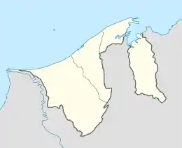 Location in Brunei | |
| Coordinates: 4°49′12″N 114°49′00″E | |
| Country | Brunei |
| District | Brunei-Muara |
| Mukim | Pengkalan Batu |
| Government | |
| • Village head | Saban Lamat |
| Area | |
| • Total | 978.07 ha (2,416.86 acres) |
| Population | |
| • Total | 1,453 |
| • Density | 150/km2 (380/sq mi) |
| Postcode | BH2923 |
Geography
As a subdivision, Kampong Batong borders Kampong Katimahar and Kampong Kulapis to the north, Kampong Bebatik and Kampong Masin to the north-east, Kampong Parit to the east, Kampong Pengkalan Batu to the south-east, Kampong Panchor Murai to the south, and Kampong Maraburong and Kampong Kupang in Tutong District to the west.[5]
References
- Pengiran Md. Noor, Pengiran Fatimah (2 May 2015). "Keindahan Kampung Batong berlatarbelakangkan sawah padi". Pelita Brunei (in Malay). Retrieved 15 July 2018.
- "Geoportal - Survey Department". survey.gov.bn. Retrieved 15 July 2018.
- "postcodes". post.gov.bn. Retrieved 15 July 2018.
- "Kampong Batong, Pengkalan Batu, Brunei Muara: BH2923". brn.postcodebase.com. Retrieved 15 July 2018.
- "Geoportal - Survey Department". survey.gov.bn. Retrieved 28 August 2018.
This article is issued from Wikipedia. The text is licensed under Creative Commons - Attribution - Sharealike. Additional terms may apply for the media files.