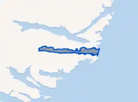
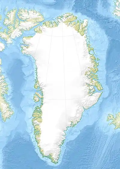
Kangerluaraq
Kangerluaraq,[1] old spelling Kangerdluaraq, is a fjord in the King Frederick VI Coast, Kujalleq municipality, southern Greenland.[2]
| Kangerluaraq | |
|---|---|
| Kangerdluaraq | |
Location of Kangerluaraq | |
 Kangerluaraq Location in Greenland | |
| Location | Arctic (SE Greenland) |
| Coordinates | 60°35′N 42°59′W |
| Ocean/sea sources | North Atlantic Ocean |
| Basin countries | Greenland |
| Max. length | 24 km (15 mi) |
| Max. width | 1.7 km (1.1 mi) |
Geography
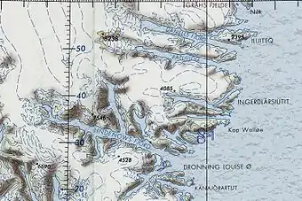
Kangerluaraq is a narrow fjord lying between the Kuutseq to the north and the Nattoralik and Nanuuseq fjords to the south. It extends in a roughly east–west direction from its mouth in the North Atlantic Ocean for about 24 km until its head. Its entrance is on the northern side of Cape Walløe (Kangersivasik).[3]
In the same manner as in the fjords further north, dark-hued mountains rise steeply from the shore on both sides. However, there are no glaciers reaching down to the waterline in Kangerluaraq, the fjord ending in a steep and narrow valley at its western end.[4]
 Map of Greenland section showing Kangerluaraq |
See also
References
- Den grønlandske Lods - Geodatastyrelsen
- Prostar Sailing Directions 2005 Greenland and Iceland Enroute, p. 100
- "Kangerdluaraq". Mapcarta. Retrieved 6 May 2016.
- GoogleEarth
External links
- Den grønlandske Lods - Sejladsanvisninger Østgrønland
- Ketilidian structure and the rapakivi suite between Lindenow Fjord and Kap Farvel, South-East Greenland
- The Ketilidian orogen of South Greenland: geochronology, tectonics, magmatism, and fore-arc accretion during Palaeoproterozoic oblique convergence
This article is issued from Wikipedia. The text is licensed under Creative Commons - Attribution - Sharealike. Additional terms may apply for the media files.