Kangphu Kang
Kangphu Kang or Shimokangri is a mountain in the Himalayas. At 7,204 m (23,635 ft) above sea level it is the 107th highest mountain in the world. The peak is located on the border of Bhutan and China (Tibet).
| Kangphu Kang | |
|---|---|
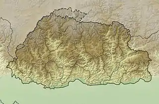 Kangphu Kang Location in Bhutan, on the border with China | |
| Highest point | |
| Elevation | 7,204 m (23,635 ft) [1] Ranked 107th |
| Prominence | 1,240 m (4,070 ft) [1] |
| Parent peak | Tongshanjiabu |
| Coordinates | 28°09′24″N 90°04′15″E [2] |
| Geography | |
| Location | Bhutan–China border |
| Parent range | Himalayas |
| Climbing | |
| First ascent | 29 September 2002 by a South Korean expedition[2] |
| Easiest route | snow/ice climb |
The mountain has a western and eastern summit connected by a high ridge not dipping below 7,000 m. From the lower western summit (28°09′20″N 90°03′48″E, 7,147 m on China's 1:50,000 People Liberation Army map),[2] a 15 km north ridge including a 6,902 m summit branches of the main divide. The main ridge drops steeply from the west peak to a 6,040 m pass, separating it from Jejekangphu Kang (6,965 m; 28°08′43″N 90°01′24″E).[3] On the other side, the main ridge drops southeast from the east peak to a 6,220 m pass leading to Kangphu Kang II or Dop Kang (6,945 m; 28°08′30″N 90°06′03″E).[4]
Kangphu Kang was first climbed over the north-face on 29 September 2002 by a South Korean expedition.[2]
See also
References
- "Kangphu Kang, Bhutan/China". Peakbagger.com. Retrieved 2014-08-04.
- Tamotsu Nakamura, First Ascent of Shimokangri on Tibet-Bhutan border, Man and Mountain, 2002, pp. 41-44
- "Jejekangphu Kang, Bhutan". Peakbagger.com. Retrieved 2014-08-04.
- "Kangphu kang II, Bhutan". Peakbagger.com. Retrieved 2014-08-04.