Kartung
Kartung or Kartong is a coastal village in south-western Gambia on the border with Senegal. It is located approximately 60 kilometres from Banjul and 9.5 kilometres from Gunjur. It is located in Kombo South District in the Western Division. As of 2009, it has an estimated population of 5213.[1]
Kartung | |
|---|---|
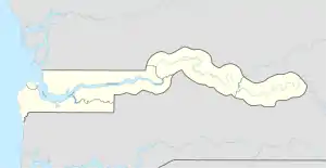 Kartung Location in the Gambia | |
| Coordinates: 13°6′N 16°46′W | |
| Country | |
| Division | West Coast Region |
| District | Kombo South |
| Population (2009) | |
| • Total | 5,213 (est.) |
| Website | Website |
The village stands on the bank of the Hallahin Bolong River and is accessed by canoes.
Kartung is a multi-ethnic and religious village, but the most dominant religion is Islam that gave rise to the sacred place Folonko.
Climate
Kartong has a tropical savanna climate (Aw) with no rainfall from November to May and heavy to very heavy rainfall from June to October.
| Climate data for Kartong | |||||||||||||
|---|---|---|---|---|---|---|---|---|---|---|---|---|---|
| Month | Jan | Feb | Mar | Apr | May | Jun | Jul | Aug | Sep | Oct | Nov | Dec | Year |
| Average high °C (°F) | 31.5 (88.7) |
32.9 (91.2) |
33.8 (92.8) |
32.8 (91.0) |
32.0 (89.6) |
31.5 (88.7) |
30.4 (86.7) |
29.9 (85.8) |
30.4 (86.7) |
31.8 (89.2) |
32.3 (90.1) |
31.1 (88.0) |
31.7 (89.0) |
| Daily mean °C (°F) | 23.5 (74.3) |
24.5 (76.1) |
25.7 (78.3) |
25.7 (78.3) |
26.3 (79.3) |
27.0 (80.6) |
26.9 (80.4) |
26.4 (79.5) |
26.5 (79.7) |
27.0 (80.6) |
26.0 (78.8) |
23.7 (74.7) |
25.8 (78.4) |
| Average low °C (°F) | 15.5 (59.9) |
16.1 (61.0) |
17.6 (63.7) |
18.7 (65.7) |
20.6 (69.1) |
22.5 (72.5) |
23.4 (74.1) |
23.0 (73.4) |
22.7 (72.9) |
22.3 (72.1) |
19.7 (67.5) |
16.3 (61.3) |
19.9 (67.8) |
| Average rainfall mm (inches) | 0 (0) |
0 (0) |
0 (0) |
0 (0) |
2 (0.1) |
65 (2.6) |
240 (9.4) |
390 (15.4) |
263 (10.4) |
77 (3.0) |
2 (0.1) |
1 (0.0) |
1,040 (41) |
| Source: Climate-Data.org[2] | |||||||||||||
References
- "Gambia: largest cities and towns and statistics of their population". World Gazetteer. Archived from the original on May 22, 2011. Retrieved January 3, 2009.
- "Climate: Kartong". Climate-Data.org. Retrieved August 6, 2020.
This article is issued from Wikipedia. The text is licensed under Creative Commons - Attribution - Sharealike. Additional terms may apply for the media files.